Maps
TopoKit opens georeferenced GeoPDF and GeoTIFF files, but finding maps for a particular area isn't always easy. I've put together a list of places to get them across Canada, the United States, Australia, New Zealand, the UK, Ireland, Spain, Portugal and France. It includes free and paid downloads, along with XYZ and WMS map services that you can add to TopoKit and save for offline use.
I've been collecting map sources as I've come across them over the past few years, and while I've tried to include as many as I can, this is by no means a complete list. If you know of any I've missed, you can suggest them using the form at the bottom of the page.
Each country starts with national map sources, followed by maps for individual provinces, states and regions. Each entry explains what's available, where to get it and whether it's free. I checked the sources in October 2026. For help adding them to TopoKit, see Raster overlays for files or Tile layers for map services.
Some services need an API key or limit offline downloads, so check each source's terms.
Canada · United States · Australia · New Zealand · United Kingdom · Ireland · Spain · Portugal · France · Add or fix a map · 211 sources
No maps found. Try a different place or search term.
Canada
Nationwide
Toporama, the national topographic map
Natural Resources Canada · WMS · Free · Open Government Licence – Canada, commercial use allowed · NRCan web services
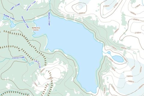
Natural Resources Canada's topographic map of the whole country, with contours, waterways, roads, vegetation and place names.
How to add this service
- WMS address:
https://maps.geogratis.gc.ca/wms/toporama_en. The layer is WMS-Toporama.
Report a problem with this entry
Scanned NTS paper maps, 1:50,000 and 1:250,000
Natural Resources Canada · GeoTIFF, GeoPDF for CanTopo · Free · Open Government Licence – Canada, commercial use allowed · Dataset record
Every printed NTS sheet at 1:50,000 and 1:250,000, scanned and georeferenced, from 1944 to 2005, plus the newer CanTopo sheets for about 2,200 northern areas; no longer updated.
How to download
- Download the sheet index, topographic_index_50k.kmz, and read the sheet number over your area, such as
092B05.
- Open the folder for that sheet under …/raster/topographic/50k/: the first three characters, then the letter, then the two digits (
50k/092/b/05/).
- Download the
canmatrix_geotiff.zip with the highest edition number (about 10 MB), or the cantopo_geopdf.zip when there is one. The 1:250,000 sheets are under 250k/092/b/.
Report a problem with this entry
Canada Base Map – Transportation (WMS)
Natural Resources Canada · WMS · Free · Open Government Licence – Canada · Open Canada record · Service page
NRCan's general-purpose base map with an emphasis on roads and transportation, as WMS; layer CBMT in English, or CBCT at cartes.geogratis.gc.ca in French.
How to add this service
- CBMT:
https://maps.geogratis.gc.ca/wms/CBMT
Report a problem with this entry
HRDEM hillshade
Natural Resources Canada · WMS · Free · Open Government Licence – Canada · Open Canada record · Service page
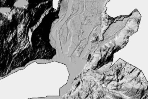
Hillshade of NRCan's high-resolution digital elevation mosaic, bare earth (dtm-hillshade) or surface (dsm-hillshade), with colour-relief and slope layers, as WMS.
How to add this service
- HRDEM hillshade:
https://datacube.services.geo.ca/wrapper/ogc/elevation-hrdem-mosaic
Report a problem with this entry
CanVec WMS
Natural Resources Canada · WMS · Free · Open Government Licence – Canada · Service page
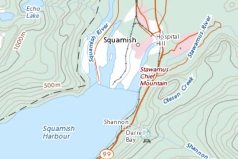
Multiscale rendering of NRCan's CanVec topographic vector data (land, hydro and man-made themes), as WMS; root layer canvec.
How to add this service
- CanVec:
https://maps.geogratis.gc.ca/wms/canvec_en
Report a problem with this entry
Nautical charts (WMS)
Canadian Hydrographic Service · WMS · Free · Open Government Licence – Canada, commercial use allowed · Open Canada record · Service page
Canada's nautical charts, drawn from the Canadian Hydrographic Service's electronic navigational charts, with depths, soundings, buoys, lights, hazards and port features.
How to add this service
- Add the address below as a WMS service three times, picking one layer each time, in this order: Natural and man-made features, port features for the land and shore, Depths, currents, etc for the water, then Buoys, beacons, lights, fog signals, radar, so the buoys draw on top.
- Add Seabed, obstructions, pipelines the same way for rocks, wrecks and other hazards. Each layer downloads separately for offline use.
- CHS chart service, WMS 1.3.0:
https://egisp.dfo-mpo.gc.ca/arcgis/rest/services/chs/ENC_MaritimeChartService/MapServer/exts/MaritimeChartService/WMSServer
The service says it is not for navigation.
Report a problem with this entry
Alberta
3 file sources
Alberta Public Land Use Zone maps
Government of Alberta (Forestry and Parks) · GeoPDF · Free · Terms not stated · Public land recreation maps
Zone-by-zone maps of designated trails and roads in Alberta's Public Land Use Zones, published as georeferenced PDFs on open.alberta.ca and reissued most years.
How to download
- Open Alberta's Public land recreation maps page.
- In the Designated Trails and PLUZ table, follow the link in the Georeferenced column for the zone.
- On the publication page, download the current map; skip entries marked archived or superseded.
Report a problem with this entry
Kananaskis Country maps
Alberta Parks (Government of Alberta, Forestry and Parks) · GeoPDF · Free · Terms not stated · Kananaskis Country library
Alberta Parks' Kananaskis trail maps and wildlife management unit maps whose titles say Geo Referenced: five regional trail maps, four West Bragg Creek maps and six WMU maps.
How to download
- Open the Kananaskis Country library on albertaparks.ca.
- In the Maps sections, download a title ending in (Geo Referenced) or (Georeferenced).
Report a problem with this entry
Bragg Creek Trails maps
Bragg Creek Trails · GeoPDF · Free · Terms not stated · Maps
The full and central West Bragg Creek trail maps (December 2020) as georeferenced PDFs.
How to download
- Open the Bragg Creek Trails maps page.
- Use Download pdf of Full Bragg Creek Trails or Download pdf of Central Bragg Creek Trails.
Report a problem with this entry
British Columbia
9 file sources, 4 services
BC 1:20,000 topographic maps
GeoBC · GeoPDF, GeoTIFF · Free · Personal use only, the licence in the download forbids commercial use and redistribution · Catalogue record
The provincial 1:20,000 topographic map, one sheet per BCGS mapsheet, with contours, roads, water and names over shaded relief; the PDF is about 5 MB, the GeoTIFF zip about 10 MB.
How to download
- Find the mapsheet number with the BC mapsheet search: zoom in until the 1:20,000 grid appears and read the number, such as
092B043.
- PDF: open pub.data.gov.bc.ca/datasets/177864/pdf/, then the folder named by the first four characters in lower case (
092b), then the file (092B043.pdf).
- GeoTIFF: open …/datasets/177864/tif/, then the folder for the UTM zone (
utm07 to utm11, or bcalb for BC Albers), then the same four-character folder, and download the zip. The .tif inside is the map.
Report a problem with this entry
BC Geographic Warehouse WMS
DataBC, Province of British Columbia · WMS · Free · Varies by layer · GetCapabilities · BC Data Catalogue
A WMS with hundreds of BC government map layers, including contours, trails, forest roads, parks, waterways and avalanche terrain.
How to add this service
- Add the WMS address below and pick the layers you want; layer names start with
pub:.
- To see every layer, open the GetCapabilities list.
- WMS:
https://openmaps.gov.bc.ca/geo/pub/wms
Useful layers include pub:WHSE_BASEMAPPING.TRIM_CONTOUR_LINES, pub:WHSE_TANTALIS.TA_PARK_ECORES_PA_SVW (parks), pub:WHSE_FOREST_TENURE.FTEN_RECREATION_LINES_SVW (recreation trails) and pub:WHSE_FOREST_TENURE.FTEN_ROAD_SECTION_LINES_SVW (forest roads). Each layer keeps its own licence, Open Government Licence or Access Only, shown on its record in the BC Data Catalogue.
Report a problem with this entry
BC hunting management unit maps
Province of British Columbia · GeoPDF · Free · Terms not stated · Hunting and Trapping Regulations Synopsis
Hunting management unit maps for all eight BC regions as GeoPDFs, plus maps of closed areas and special seasons, about two-thirds of them georeferenced.
How to download
- Open the Hunting and Trapping Regulations Synopsis page.
- Under Management unit maps, download the map for your region.
- For closed areas and special seasons, expand your region under Detailed Hunting and Trapping Synopsis maps.
The region maps are 26 to 48 MB. The area maps that are not georeferenced are mostly the small Peace region closure maps and the Vancouver Island highway maps.
Report a problem with this entry
BC motor vehicle prohibition maps
Province of British Columbia · GeoPDF · Free · Terms not stated · Motor Vehicle Prohibitions
Close to 200 georeferenced PDF maps of the areas where motor vehicles, ATVs, e-bikes or snowmobiles are prohibited or restricted, on one page per hunting region.
How to download
- Open the Motor Vehicle Prohibitions page and choose your region under Motor vehicle prohibition and restriction maps.
- Download the map for the area.
The province says more maps will move to these pages; until then the rest are in the hunting synopsis.
Report a problem with this entry
BC snowmobile closure maps
Province of British Columbia · GeoPDF · Free · Terms not stated · Snowmobile Closures
Georeferenced PDF maps of the snowmobile closures in the mountain caribou range, with open riding areas and trails, as regional overviews and detailed sheets.
How to download
- Open the Snowmobile Closures page.
- Download the regional overview or the detailed sheet for the area.
The same closures are on the page as KML and GPX.
Report a problem with this entry
BC imagery and hillshade WMS
Province of British Columbia (GeoBC) · WMS · Free · Access Only · Catalogue record
BC's imagery WMS, with a province-wide hillshade in grey or colour, painted relief, and older air photo and satellite mosaics.
How to add this service
- WMS:
https://openmaps.gov.bc.ca/imagex/ecw_wms.dll
Hillshade layers are hillshade_bc_bcalb_hillshade_clr_315 (colour) and hillshade_bc_bcalb_hillshade_bw_315 (grey).
Report a problem with this entry
BC web mercator base map
Province of British Columbia (DataBC / GeoBC) · XYZ · Free · Access Only, no reproduction without permission · Service page · Catalogue record
The provincial base map with relief, roads, place names and building footprints, cached to zoom 17.
How to add this service
- Tiles:
https://maps.gov.bc.ca/arcgis/rest/services/province/web_mercator_cache/MapServer/tile/{z}/{y}/{x}
- Tiles, delivery server:
https://delivery.maps.gov.bc.ca/arcgis/rest/services/province/web_mercator_cache/MapServer/tile/{z}/{y}/{x}
Under the Access Only licence the province does not allow reproduction without written permission, so check the terms before saving large areas for offline use.
Report a problem with this entry
BC roads base map
Province of British Columbia (DataBC / GeoBC) · XYZ · Free · Terms not stated · Service page · Catalogue record
The provincial road network as an opaque base map, cached to zoom 23.
How to add this service
- Roads tiles:
https://maps.gov.bc.ca/arcgis/rest/services/province/roads_wm/MapServer/tile/{z}/{y}/{x}
- Roads tiles:
https://delivery.maps.gov.bc.ca/arcgis/rest/services/province/roads_wm/MapServer/tile/{z}/{y}/{x}
Report a problem with this entry
Sunshine Coast Trail section maps
qathet Parks and Wilderness Society · GeoPDF · Free · No licence stated, treat as personal use · Maps page
Eleven section maps of the 180 km trail at 1:15,000 to 1:35,000, with huts, campsites and kilometre markers; the page does not say so, but the PDFs are georeferenced.
How to download
- Open the maps page and tap a section to open its PDF, then save it.
Report a problem with this entry
CRD regional park maps
Capital Regional District · GeoPDF · Free · Terms not stated · Regional park maps
Trail maps for 18 Capital Regional District parks as GeoPDFs with switchable layers, showing colour-coded trails, distances and designated uses.
How to download
- Open the CRD Regional Park Maps page.
- Click the link labelled Geo PDF with layers for the park; maps without that label are ordinary PDFs.
Report a problem with this entry
Regional District of Nanaimo park and trail maps
Regional District of Nanaimo · GeoPDF · Free · All rights reserved · GIS & Mapping
Twenty-three regional park and trail maps as georeferenced PDFs, including the Trans Canada Trail through the district in three sheets.
How to download
- Open the RDN GIS & Mapping page and scroll to Parks and Trails PDF Map.
- Click the park or trail name; the georeferenced files are named
RDNGeoPDF_….
Report a problem with this entry
Nymph Falls Nature Park map
Comox Valley Regional District · GeoPDF · Free · Terms not stated · Nymph Falls Nature Park
Trail map of the park's hiking and mountain-bike trails along the Puntledge River, posted as a georeferenced PDF.
How to download
- Open the CVRD Nymph Falls Nature Park page.
- Click Nymph Falls Nature Park Georeferenced Trail Map, not the brochure map.
Report a problem with this entry
Garibaldi Park wilderness camping and flight zone maps
BC Parks · GeoPDF · Free · Terms not stated, BC Parks says its maps are for information only and should not be used for navigation · Garibaldi Park
Two maps of the park as GeoPDFs: the wilderness camping area map, one 72 by 72 inch page of about 21 MB, and the voluntary flight zones map; BC Parks labels only the second as georeferenced.
How to download
- Open the Garibaldi Park page, go to Maps and location and download Wilderness Camping Area [PDF] or Garibaldi georeferenced voluntary flight zones [PDF].
Report a problem with this entry
New Brunswick
1 service
New Brunswick LiDAR hillshade
New Brunswick Department of Natural Resources · WMS · Free · Terms not stated · Service page
Multidirectional hillshade of New Brunswick from the 1 m LiDAR elevation model, as WMS.
How to add this service
- WMS:
https://gis-erd-der.gnb.ca/server/services/LidarProducts/MultiDirectHillshade/ImageServer/WMSServer
Layer 0. The service does not list web mercator but draws in it.
Report a problem with this entry
Newfoundland and Labrador
2 file sources
Newfoundland moose and black bear area maps
Government of Newfoundland and Labrador · GeoPDF · Free · All rights reserved · Big Game Management Areas
A 17 × 22 inch map of each big game management area, published as GeoPDFs although the page does not say so.
How to download
- Open the Newfoundland Big Game Management Areas page and click your area.
Report a problem with this entry
Gros Morne Long Range and Northern Traverse map
Parks Canada · GeoPDF · Free · Terms not stated · Long Range Traverse
The park's backcountry hiking map of the Long Range and Northern traverses, one 36 by 28 inch page of about 32 MB, with GPX tracks of both routes on the same page. The page doesn't say so, but the PDF is georeferenced.
How to download
- Open the Long Range Traverse page and, under Download, tap Long Range & Northern Traverse Backcountry Hiking Map.
Report a problem with this entry
Northwest Territories
1 file source
Mobile Core Bathurst Caribou Management Zone map
Government of the Northwest Territories, Environment and Climate Change (ECC); catalogued by the NWT Centre for Geomatics · GeoPDF · Free · Terms not stated · Current zone map · Map with instructions
The weekly regulatory map of the no-hunting zone that follows the Bathurst caribou herd, reissued every Tuesday.
How to download
- Open ECC's View current Mobile Core Bathurst Caribou Management Zone page.
- Click View the most recent map and save the PDF.
A new map is posted each week, so download again before you go.
Report a problem with this entry
Nova Scotia
1 file source
Nova Scotia 1:10,000 topographic sheets
Nova Scotia Geomatics Centre (GeoNOVA / NSGI), Province of Nova Scotia · GeoPDF · Free · NSGI unrestricted licence · Base mapping · Data Locator
Nova Scotia's 1:10,000 topographic map sheets with 5 m contours. About a third are GeoPDFs so far, and the index shows which.
How to download
- Open the Data Locator Indexing System and choose the 1:10,000 Digital topographic index.
- Click a sheet; its Plot Format field reads PDF or GeoPDF.
- Add the PDF/JPG product to your downloads and download it. The Georeferenced JPG product is a JPG with a world file, which TopoKit does not open.
578 of the 1,599 sheets are GeoPDFs; the rest are plain PDF plots.
Report a problem with this entry
Ontario
3 file sources, 2 services, 1 paid
Ontario topographic base map
Geospatial Ontario · XYZ · Free · Open Government Licence – Ontario, commercial use allowed · Dataset record
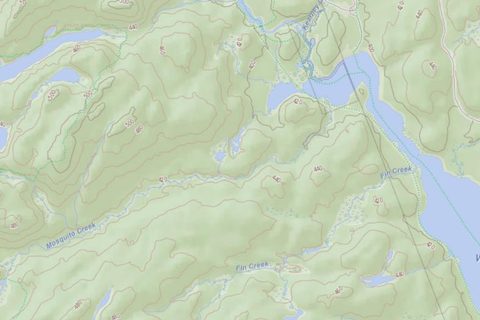
The provincial topographic base map as a tile service, in muted colours; the cache was last refreshed in 2020.
How to add this service
- Address:
https://ws.lioservices.lrc.gov.on.ca/arcgis1061a/rest/services/LIO_Cartographic/LIO_Topographic/MapServer/tile/{z}/{y}/{x}
Report a problem with this entry
Maps by Jeff
Maps by Jeff (Unlostify) · GeoTIFF · Paid, $25 to $30 per map, paper and files together · Terms not stated · mapsbyjeff.com
The Ontario canoe-country maps (Algonquin, Temagami, Killarney, French River, Kawartha Highlands, the Massasauga); every paper map comes with its digital files by email, a GeoTIFF among them.
How to buy
- Buy the map on mapsbyjeff.com; the files arrive by email. There is no digital-only purchase.
Report a problem with this entry
Ontario Imagery Web Map Service
Geospatial Ontario, Ontario Ministry of Natural Resources · XYZ · Free · Open Government Licence – Ontario · Service page · Ontario Data Catalogue
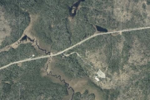
Province-wide orthophoto mosaic of 16–50 cm aerial imagery from the regional acquisition programs, with satellite imagery in the Far North, updated yearly.
How to add this service
- Tiles:
https://ws.lioservices.lrc.gov.on.ca/arcgis2/rest/services/LIO_Imagery/Ontario_Imagery_Web_Map_Service/MapServer/tile/{z}/{y}/{x}
The companion Ontario_Imagery_Web_Map_Service_Source service shows the year and sensor of each area.
Report a problem with this entry
Lake Superior Provincial Park route maps
Ontario Parks · GeoPDF · Free · Terms not stated · Park maps
Eight canoe route and walk-in route maps of Lake Superior Provincial Park, published as GeoPDFs.
How to download
- Open the park's Maps page on ontarioparks.ca.
- Download a canoe route or walk-in route map; the park map, the campground maps and the Sand River map are plain PDFs.
Report a problem with this entry
Queen Elizabeth II Wildlands backcountry map
Ontario Parks · GeoPDF · Free · Terms not stated · Park maps
The park's backcountry hiking and canoe route map, published as a GeoPDF.
How to download
- Open the park's Maps page on ontarioparks.ca and download the backcountry hiking and canoe routes map.
Report a problem with this entry
Prince Edward Island
1 file source, 1 paid
PEI 2020 orthophoto
Government of Prince Edward Island · GeoTIFF · Paid, $0.02 per hectare · Terms not stated · GIS Products and Price List
The 2020 30 cm colour and infrared orthophoto of Prince Edward Island, sold by area as GeoTIFF.
How to buy
- Find PEI 2020 RGB-IR Orthomap 30cm on the GIS Products and Price List page.
- Order by phone from Environment, Water and Climate Change at (902) 368-5634.
A media charge applies.
Report a problem with this entry
Québec
4 file sources, 2 services
Québec 1:20,000 topographic maps
Ministère des Ressources naturelles et des Forêts · XYZ, GeoTIFF · Free · CC BY 4.0, commercial use allowed · Dataset record
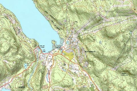
The BDTQ 1:20,000 series, 2,765 sheets covering Québec south of the 52nd parallel, with relief shading; archived, from photography of 1950 to 2006.
How to add this service
- As files, open the dataset record and follow Répertoire complet (format GeoTIFF, projection MTM), or use Télécharger par feuillet to pick one sheet.
Report a problem with this entry
Québec 1:250,000, 1:100,000 and 1:1,000,000 raster maps
Ministère des Ressources naturelles et des Forêts du Québec (Gouvernement du Québec) · WMS · Free · CC BY 4.0 · Service page · Données Québec record
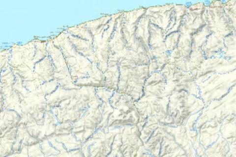
Québec's topographic maps at 1:100,000, 1:250,000 and 1:1,000,000, in colour or black and white, as WMS.
How to add this service
- Cartes_Images WMS 1.3.0 GetMap:
https://servicesmatriciels.mern.gouv.qc.ca/erdas-iws/ogc/wms/Cartes_Images?
- WMTS RESTful tile template:
https://servicesmatriciels.mern.gouv.qc.ca/erdas-iws/ogc/wmts/Cartes_Images/BDTA-250K/default/GoogleMapsCompatibleExt2:epsg:3857/{z}/{y}/{x}.jpg
Layers include BDTA-250K, BDTA-250K_Allegee_NB, BDAT-100K_Allegee, BDAT-100K_Allegee_NB and the BDGA-1M_* sheets. The second address is the 1:250,000 as a tile layer.
Report a problem with this entry
Québec 1:100,000 topographic maps
Ministère des Ressources naturelles et des Forêts · GeoTIFF · Free · CC BY 4.0 · Données Québec record
The archived 1:100,000 topographic sheets of Québec (1950 to 2006) as GeoTIFF.
How to download
- Open the Données Québec record for the 1:100,000 maps.
- Use the sheet download map, or open the full GeoTIFF directory, and download your sheet.
Report a problem with this entry
Sépaq park maps
Sépaq · GeoPDF · Free · Terms not stated · Example: Mont-Tremblant national trail map
General, trail and winter maps of Québec's national parks, published as GeoPDFs on sepaq.com; the fishing maps are plain PDFs.
How to download
- Open the park's page on sepaq.com and download the map from its maps section.
Report a problem with this entry
Sentier international des Appalaches section maps
Sentier international des Appalaches – Québec (SIA-QC) · GeoPDF · Free · Terms not stated · Cartes et tableaux des distances
Official trail maps of the Québec section of the International Appalachian Trail, in three sections, with GPX tracks on the same page.
How to download
- Open the Cartes et tableaux des distances page on sia-iat.com.
- In the Avenza Maps section, click the PDF link for the section you want.
Report a problem with this entry
Gatineau Park trail maps
National Capital Commission / Commission de la capitale nationale · GeoPDF · Free · Terms not stated · Gatineau Park trails map
The NCC's official summer and winter trail maps and camping maps of Gatineau Park as free PDFs; the NCC says the official trail maps are georeferenced.
How to download
- Open the NCC Gatineau Park trails map page.
- Scroll to the PDF list and download the summer or winter trail map.
Report a problem with this entry
Saskatchewan
1 service
Saskatchewan orthophotos
Saskatchewan Geospatial Imagery Collaborative · WMS · Free · Public use, not for resale · Service page
Province-wide 40 cm aerial orthophotos of Saskatchewan, as WMS.
How to add this service
- WMS:
https://gis.saskatchewan.ca/imagery/services/SGIC_Public_Orthophotos/ImageServer/WMSServer
Layer SGIC_Public_Orthophotos. The service does not list web mercator but draws in it.
Report a problem with this entry
Backroad Mapbooks' PDF mapbooks are not georeferenced. Gem Trek, John Baldwin, Trail Ventures BC, Wild Coast, Chrismar, GoTrekkers (the Great Divide Trail) and the East Coast Trail Association sell paper maps. Fundy Hiking Trails prints the Fundy Footpath maps only in its guidebook. The West Coast Trail, Juan de Fuca Marine Trail, North Coast Trail and Howe Sound Crest Trail maps that Parks Canada and BC Parks post are not georeferenced, and neither are the Kettle Valley Rail Trail maps from BC Rail Trails and BC Parks. Nova Scotia Parks' Cape Chignecto maps and the free Great Divide Trail guidebook topo set are not georeferenced either. The Trans Canada Trail's own map is a web map with GPX and KML downloads; the Regional District of Nanaimo sheets above include its section of the trail.
United States
Nationwide
US Topo quadrangles
US Geological Survey · GeoPDF, GeoTIFF · Free · Public domain · topoView
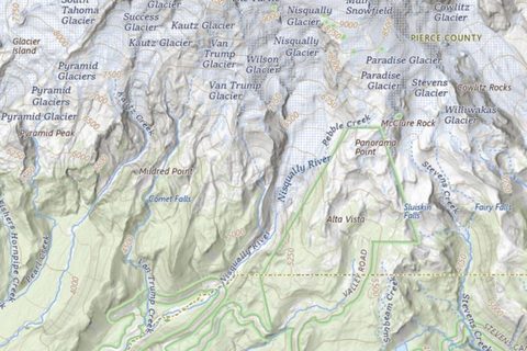
The current 7.5-minute, 1:24,000 maps of the whole country, about 65,000 sheets; GeoPDFs of 15 to 45 MB from the USGS, and GeoTIFFs of 3 to 10 MB from topoView.
How to download
- In topoView, choose UST and 24K, search a place or tap the map, open the newest record and download the GeoTIFF or the GeoPDF.
- The USGS Store Map Locator has the same GeoPDFs: drop a marker, tap View Products, then View PDF.
Report a problem with this entry
Historical USGS topographic maps, 1884 to 2006
US Geological Survey · GeoTIFF, GeoPDF · Free · Public domain · topoView
Every USGS topographic map printed before US Topo, more than 178,000 sheets at 1:24,000 to 1:250,000, as GeoTIFF; older sheets use NAD27.
How to download
- In topoView, choose HTMC and a scale, search or tap the map, use the year slider to narrow the list, and download the GeoTIFF.
Report a problem with this entry
USGS National Map tile services
US Geological Survey · XYZ · Free · Public domain, no restrictions
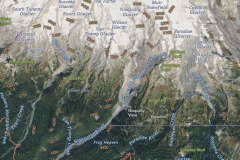
Four live services for the whole country: USGS Topo with contours and shaded relief, Imagery Topo, Imagery Only and Shaded Relief, with detail to about zoom 16.
How to add this service
- USGS Topo:
https://basemap.nationalmap.gov/arcgis/rest/services/USGSTopo/MapServer/tile/{z}/{y}/{x}
- Imagery Topo:
https://basemap.nationalmap.gov/arcgis/rest/services/USGSImageryTopo/MapServer/tile/{z}/{y}/{x}
- Imagery Only:
https://basemap.nationalmap.gov/arcgis/rest/services/USGSImageryOnly/MapServer/tile/{z}/{y}/{x}
- Shaded Relief:
https://basemap.nationalmap.gov/arcgis/rest/services/USGSShadedReliefOnly/MapServer/tile/{z}/{y}/{x}
Report a problem with this entry
FSTopo, the Forest Service topographic maps
USDA Forest Service · GeoPDF, GeoTIFF · Free · Public domain (CC0) · Forest Service Digital Maps
The Forest Service 1:24,000 quadrangles for National Forest land, with the agency's roads, trails and boundaries, updated annually.
How to download
- Open the FSTopo page of Forest Service Digital Maps, zoom to your area, tap a quad outline and tap Download PDF or Download GeoTiff. The list below the map can be filtered by state.
- The GeoTIFF zip holds two copies of the map, one in UTM and one in geographic coordinates; either one works.
Report a problem with this entry
Motor Vehicle Use Maps
USDA Forest Service · GeoPDF · Free · US government work · Forest Service maps
Each National Forest's legal map of the roads and trails open to motor vehicles and when; black and white, no terrain.
How to download
- On the forest's website: Visit, Maps & Guides, Motor Vehicle Use Maps, then the PDF.
- Or in the Forest Service Map Finder: set Map Type to MVUM, find the forest, tap a map outline and download the geospatial PDF.
Report a problem with this entry
BLM georeferenced PDF maps
Bureau of Land Management · GeoPDF · Free · US government work · Georeferenced PDF maps
Recreation, travel-management and surface-management maps for BLM land in the western states; coverage and age vary by state.
How to download
- Open the collection page, pick the state, tap a map title, then the PDF link on its page.
Report a problem with this entry
NOAA Custom Chart, nautical charts for any area
NOAA Office of Coast Survey · GeoPDF · Free · Public domain (CC0) · NOAA Custom Chart
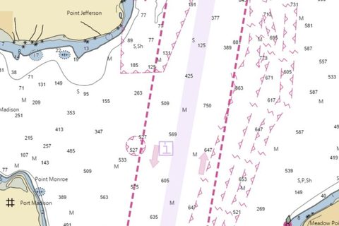
A paper-style nautical chart of any area you draw, at the scale you choose, built from the current electronic chart data; the PDF is georeferenced.
How to download
- In the NOAA Custom Chart app, set a name, scale and page size under Chart Settings, tap Create New Chart and tap the map to place it.
- Under Export Functions, select the chart, tap Export Selected Charts and save the PDF. The chart is page 1.
Report a problem with this entry
National Park Service park maps
National Park Service, Harpers Ferry Center · GeoPDF · Free · Public domain · NPS Carto · Map information
The Harpers Ferry Center park brochure maps, about 200 of which are offered as geospatial PDFs on the NPS Carto portal.
How to download
- Open nps.gov/carto and search by park name or click the state.
- Open the park's map listing and choose the Geospatial PDF download where it is offered.
Brochure maps, not topographic.
Report a problem with this entry
National wildlife refuge maps
U.S. Fish and Wildlife Service, National Wildlife Refuge System · GeoPDF · Free · US government work · Example: Minnesota Valley hunting map · Example: Blackwater trail map
Hunt unit, trail and paddling maps for individual refuges, posted as georeferenced PDFs in each refuge's document library on fws.gov.
How to download
- Open the refuge's page on fws.gov and select View Our Library.
- Look for entries labelled Geospatial PDF, georeferenced or Avenza map and download the PDF.
Report a problem with this entry
USGS NAIP Plus imagery
U.S. Geological Survey, The National Map · WMS · Free · Public domain · Service page
Natural-colour aerial imagery of the United States at 6 inch to 1 m, combining NAIP and HRO, as WMS from The National Map.
How to add this service
- NAIP Plus natural colour:
https://imagery.nationalmap.gov/arcgis/services/USGSNAIPPlus/ImageServer/WMSServer
- NAIP natural colour:
https://imagery.nationalmap.gov/arcgis/services/USGSNAIPImagery/ImageServer/WMSServer
Layer USGSNAIPPlus:NaturalColor; the plain NAIP service on the second address uses USGSNAIPImagery:NaturalColor.
Report a problem with this entry
USGS 3DEP hillshade
U.S. Geological Survey, 3D Elevation Program · WMS · Free · Public domain · Service page
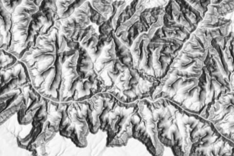
Hillshade layers (grey, multidirectional and elevation-tinted) plus slope, aspect and contours rendered from the 3DEP elevation model, as WMS.
How to add this service
- 3DEP hillshade:
https://elevation.nationalmap.gov/arcgis/services/3DEPElevation/ImageServer/WMSServer
Layers such as 3DEPElevation:Hillshade Multidirectional and 3DEPElevation:Hillshade Elevation Tinted.
Report a problem with this entry
NOAA chart display WMS
NOAA Office of Coast Survey · WMS · Free · Public domain · NOAA GIS Data & Services · Service page
Nautical chart images rendered weekly from NOAA ENC data, in traditional paper-chart symbology on the first address and S-52 symbology on the second.
How to add this service
- NOAA Chart Display Service, WMS 1.3.0:
https://gis.charttools.noaa.gov/arcgis/rest/services/MCS/NOAAChartDisplay/MapServer/exts/MaritimeChartService/WMSServer
- ECDIS Display Service, WMS 1.3.0:
https://gis.charttools.noaa.gov/arcgis/rest/services/MCS/ENCOnline/MapServer/exts/MaritimeChartService/WMSServer
Report a problem with this entry
Forest Service forest and ranger district maps
USDA Forest Service · GeoPDF · Free · Public domain (CC0) · Forest Service Digital Maps
Whole-forest maps, mostly at 1:63,360 to 1:158,400, and ranger district maps at 1:63,360 or 1:126,720, with land ownership, roads, trails and recreation sites, plus a 1:100,000 series over Forest Service land; the PDFs are large, often 30 to 90 MB.
How to download
- Open Forest Service Digital Maps and choose Forest Series, Ranger District Series or 100K Series.
- Zoom to your area, tap a map outline and tap Download, or use the list below the map.
Report a problem with this entry
Alabama
1 file source
Northeast Alabama bike ride maps
Alabama Trails Foundation · GeoPDF · Free · Terms not stated · NEABA State Line 2024
Three 2024 cycling route maps from the Alabama Trails Foundation (Ladiga to the Georgia line, the Gravel Grinder and Ladiga to Terrapin Creek), as GeoPDFs.
How to download
- Open the NEABA State Line 2024 page.
- Download the PDF for the ride; the files end in
_Geo_2.pdf.
Report a problem with this entry
Alaska
3 file sources, 2 services
Alaska statewide imagery 2020
Alaska Geospatial Office (DNR Division of Geological & Geophysical Surveys) / Maxar · XYZ · Free · Terms not stated, imagery © Maxar · Service page · DGGS record · Alaska Geospatial Office
50 cm Maxar satellite mosaic of the whole state from 2020, cached to zoom 23.
How to add this service
- AHRI 2020 RGB imagery:
https://geoportal.alaska.gov/arcgis/rest/services/ahri_2020_rgb_cache/MapServer/tile/{z}/{y}/{x}
A colour-infrared version is served as ahri_2020_cir_cache on the same server.
Report a problem with this entry
Alaska SPOT5 imagery 2013
Alaska Geospatial Office (DNR) · XYZ · Free · Terms not stated · Service page
2.5 m SPOT5 satellite imagery of the state from 2013, cached to zoom 23.
How to add this service
- SPOT5 2013 RGB:
https://geoportal.alaska.gov/arcgis/rest/services/spot5_2013_rgb_cache/MapServer/tile/{z}/{y}/{x}
Panchromatic and colour-infrared versions are spot5_2013_pan_cache and spot5_2013_cir_cache on the same server.
Report a problem with this entry
ADF&G custom hunt maps
Alaska Department of Fish and Game · GeoPDF · Free · Terms not stated · ADF&G Hunting Maps · Mobile map instructions · Statewide and per-GMU PDF maps
Hunt maps you build at hunt.alaska.gov, with game management unit and subunit boundaries, special areas and federal land over a choice of basemap, saved as a georeferenced PDF.
How to download
- Open hunt.alaska.gov and go to Maps.
- Choose Make a custom map, add the overlays you want and zoom to your area.
- Select Print and save the PDF.
A higher zoom gives a sharper map; a large hunt may need several.
Report a problem with this entry
USFWS Alaska refuge land status maps
U.S. Fish and Wildlife Service, Alaska Region (Region 7) Division of Realty · GeoPDF · Free · US government work · Land Status Maps help page · Download portal
Land ownership maps of Alaska's national wildlife refuges at 1:250,000 and 1:30,000, as GeoPDFs.
How to download
- Open the land status map series app.
- Pick the refuge and sheet from the index and download the GeoPDF.
The 1:250,000 sheets are updated quarterly and the 1:30,000 sheets each January; the 1:30,000 sheets are up to 56 × 62 inches.
Report a problem with this entry
USFWS Alaska guide use area maps
U.S. Fish and Wildlife Service, Alaska Region (Region 7) Division of Realty · GeoPDF · Free · US government work · Guide Use Area Maps help page · USFWS Region 7 Land Mapper
Maps of the areas where USFWS issues commercial guide permits on Alaska refuges, published as GeoPDFs.
How to download
- Open the Guide Use Area Maps page.
- Pick the refuge and area code and download the PDF.
Report a problem with this entry
Arizona
1 file source
Arizona Trail passage maps
Arizona Trail Association · GeoPDF · Free · Terms not stated · Passages
A one-page map for most of the trail's passages, dated 2018 to 2025, and an eight-page overview map book of the whole trail. The pages don't say so, but the PDFs are georeferenced.
How to download
- Open Passages, choose a passage and tap MAP to open its PDF.
Report a problem with this entry
Arkansas
1 file source, 1 service
AGFC wildlife management area maps
Arkansas Game and Fish Commission · GeoPDF · Free · Terms not stated · Alum Fork Natural Area WMA page · AGFC Maps resource page · Public Use Maps download site
Public use maps for each Arkansas WMA showing parking, road types and boundaries; AGFC says they are georeferenced.
How to download
- Open the AGFC Public Use Maps site.
- Pick the WMA and download its PDF.
Report a problem with this entry
Arkansas 2023 orthoimagery
Arkansas GIS Office · XYZ · Free · Terms not stated · Service page · Arkansas GIS Office geodata hub
9-inch colour aerial imagery of the whole state from 2023, cached to zoom 19.
How to add this service
- Arkansas 2023 9-inch imagery tiles:
https://gis.arkansas.gov/arcgis/rest/services/ImageServices/IMAGERY_9IN_2023/ImageServer/tile/{z}/{y}/{x}
Report a problem with this entry
California
1 file source, 1 service
CDFW NAIP imagery
California Department of Fish and Wildlife · WMS · Free · CDFW conditions of use · CDFW Map Services
Statewide NAIP aerial imagery of California for each flight from 2005 to 2022, one WMS per year.
How to add this service
- For another year, change
NAIP_2022 in the address to the year you want, such as NAIP_2020.
- 2022:
https://gis.wildlife.ca.gov/images/services/Base_Remote_Sensing/NAIP_2022/ImageServer/WMSServer
Layer 0.
Report a problem with this entry
Jackson Demonstration State Forest maps
CAL FIRE (California Department of Forestry and Fire Protection) · GeoPDF · Free · Terms not stated · Jackson Demonstration State Forest
CAL FIRE's forest base map, recreation overview map and Caspar–Big River trail map (2025–2026 editions), which the page says are georeferenced for offline use.
How to download
- Open the JDSF page.
- Click JDSF Base Map, Recreation Overview Map or Caspar-Big River Recreation Map to download.
Report a problem with this entry
Colorado
4 file sources
Colorado public imagery
State of Colorado, Governor's Office of Information Technology (OIT) GIS team · GeoTIFF · Free · CC0 1.0 · AWS Open Data registry · Colorado Public Imagery S3 browser · Colorado Public Imagery Downloader
NAIP orthoimagery of Colorado from 2005 on and DRAPP imagery of the Denver region at 3 to 12 inch, as GeoTIFF files on AWS Open Data.
How to download
- Open the S3 browser or the Colorado Public Imagery Downloader and choose a year folder.
- Pick the tile that covers your area and download the .tif.
- S3 bucket:
s3://colorado-public-imagery/
- Example NAIP 2021 COG:
https://colorado-public-imagery.s3.amazonaws.com/NAIP/NAIP2021/cogs/m_3610201_ne_13_060_20210708.tif
Files are large: a NAIP 2021 tile is 620–770 MB.
Report a problem with this entry
Colorado Parks and Wildlife map library
Colorado Parks and Wildlife · GeoPDF · Free · Terms not stated · Maps & GIS · Map Library · Hunting Atlas
CPW's library of over 900 maps, filterable to those offered as GeoPDF, plus custom GeoPDF export from the Colorado Hunting Atlas and Fishing Atlas.
How to download
- Open the CPW Map Library, filter by map type or county and download a map whose file type is GeoPDF.
- Or open the Hunting Atlas or Fishing Atlas, zoom to your area and use its print option to save a custom GeoPDF.
Report a problem with this entry
Boulder County open space map
Boulder County Parks & Open Space · GeoPDF · Free · Terms not stated · PDF maps
The county-wide open space and trails map, which the county says is a georeferenced PDF.
How to download
- Open the PDF maps page and download the open space map; the individual park maps are not described as georeferenced.
Report a problem with this entry
Continental Divide Trail section maps
Continental Divide Trail Coalition · GeoPDF · Free · Terms not stated · How to download the section maps · CDT Interactive Map
The coalition's Version 4.0 map set at half a mile to the inch, built on Forest Service data, with land ownership and an elevation profile; one page per PDF, in high or low resolution. The pages don't say so, but the PDFs are georeferenced.
How to download
- Open the CDT Interactive Map, preferably on a computer.
- Tap Layers, find Mapset Pages and tap its eye icon to show the purple page outlines.
- Tap the outline for your section and, under Download Version 4.0, choose High Resolution or Low Resolution. The PDF opens on Dropbox; tap the download icon to save it.
Report a problem with this entry
Connecticut
1 file source, 1 service
CT ECO base map and imagery
Connecticut Environmental Conditions Online (CT ECO), UConn CLEAR and CT DEEP · WMS · Free · Terms not stated · CT ECO Map and Image Services FAQ
Connecticut's base map and its orthophoto and hillshade image services from CT ECO, as WMS.
How to add this service
- Open the CT ECO FAQ and follow the REST directory links to the service you want.
- Build the WMS address from the service path as the FAQ shows.
- CT Base Map WMS:
https://cteco.uconn.edu/ctmaps/services/Base_map/CT_Base_map/MapServer/WmsServer
- Hillshade ImageServer REST:
https://cteco.uconn.edu/ctraster/rest/services/elevation/Hillshade/ImageServer
The capabilities document could not be read, so EPSG:3857 support is not confirmed.
Report a problem with this entry
CT DEEP GPS-friendly trail maps
Connecticut Department of Energy and Environmental Protection (DEEP), State Parks · GeoPDF · Free · Terms not stated · CRT - GPS Friendly Maps · Service page
Trail maps for Connecticut state parks and forests; where a park page offers a "GPS Friendly Trail Map for Mobile Apps", that file is the georeferenced edition.
How to download
- Open the DEEP Trail and Camping Maps index and click the park or forest.
- Download the file labelled GPS Friendly Trail Map for Mobile Apps; the plain Trail Map is not georeferenced.
Report a problem with this entry
Delaware
1 service
Delaware FirstMap colour base map
Delaware FirstMap (State of Delaware) · XYZ · Free · Terms not stated · Service page
Statewide street and reference base map, cached to zoom 23; a light grey version is served alongside it.
How to add this service
- Color basemap:
https://enterprise.firstmap.delaware.gov/arcgis/rest/services/Basemaps/DE_Basemap_Color/MapServer/tile/{z}/{y}/{x}
Report a problem with this entry
District of Columbia
2 services
DC GIS base map
DC Office of the Chief Technology Officer (OCTO), DC GIS · XYZ, WMS · Free · CC BY 4.0 · Service page
Street base map of the District, cached to zoom 23, also offered in light and dark grey and as WMS.
How to add this service
- DC Basemap tiles:
https://maps2.dcgis.dc.gov/dcgis/rest/services/DCGIS_DATA/DC_Basemap_WebMercator/MapServer/tile/{z}/{y}/{x}
- DC Basemap WMS:
https://maps2.dcgis.dc.gov/dcgis/services/DCGIS_DATA/DC_Basemap_WebMercator/MapServer/WMSServer
- DC Basemap Light Gray tiles:
https://maps2.dcgis.dc.gov/dcgis/rest/services/DCGIS_DATA/DC_Basemap_LightGray_WebMercator/MapServer/tile/{z}/{y}/{x}
Report a problem with this entry
DC GIS aerial imagery
DC Office of the Chief Technology Officer (OCTO), DC GIS · XYZ, WMS · Free · CC BY 4.0 · Service page
Orthophoto caches of the District: a current mosaic and dated flights from 2010 to 2025, each cached to zoom 23.
How to add this service
- DC aerial photo:
https://maps2.dcgis.dc.gov/dcgis/rest/services/DCGIS_DATA/DC_Aerial_Photo_WebMercator/MapServer/tile/{z}/{y}/{x}
- Ortho 2025:
https://maps2.dcgis.dc.gov/dcgis/rest/services/DCGIS_DATA/Ortho2025_WebMercator/MapServer/tile/{z}/{y}/{x}
Report a problem with this entry
Florida
2 file sources
Florida State Parks trail maps
Florida State Parks (Florida Department of Environmental Protection, Division of Recreation and Parks) · GeoPDF · Free · Terms not stated · Example: River Rise Preserve
Trail maps for each state park, posted as georeferenced PDFs on the park's Trail Maps page.
How to download
- Open the park's page on floridastateparks.org and choose Trail Maps.
- Download the PDFs listed under "The following downloadable PDFs are geo-referenced"; the Printable Park Map above them is not.
Report a problem with this entry
Florida Trail map, St. Marks National Wildlife Refuge
U.S. Fish and Wildlife Service · GeoPDF · Free · All rights reserved · Florida Trail map
A one-page map of the trail's segment through the refuge, dated January 2022. The page doesn't say so, but the PDF is georeferenced.
How to download
- Open the map's page and download the PDF.
Report a problem with this entry
Georgia
1 file source
Georgia WMA maps
Georgia DNR Wildlife Resources Division · PDF · Free · Terms not stated · Example: Cedar Creek WMA map
Hunting maps of Georgia's wildlife management areas, posted as PDFs; the three tested are GeoPDFs although the site does not say so.
How to download
- Open the WMA's page on georgiawildlife.com and use its map link.
Report a problem with this entry
Hawaii
1 service
Hawaii WorldView-2 imagery 2016
Hawaii Statewide GIS Program (Office of Planning and Sustainable Development) · XYZ · Free · Terms not stated · Service page
2016 WorldView-2 satellite imagery of the islands, cached to about zoom 17 with a DigitalGlobe watermark.
How to add this service
- WV2 2016 imagery:
https://geodata.hawaii.gov/arcgis/rest/services/SoH_Imagery/WV2_2016/MapServer/tile/{z}/{y}/{x}
Report a problem with this entry
Idaho
3 file sources
Idaho Fish and Game hunt area maps
Idaho Department of Fish and Game · GeoPDF · Free · Terms not stated · Hunt Area Map Index · Hunt Planner · Example: Unit 1 georeferenced PDF
A 600 dpi georeferenced PDF of every hunt area, showing the unit boundary over topography, land ownership and access.
How to download
- Open the Hunt Area Map Index and find the unit.
- Click Printable Georeferenced PDF Map in that row.
Report a problem with this entry
Idaho Park N' Ski trail maps
Idaho Department of Parks and Recreation · GeoPDF · Free · Terms not stated · Cross-Country Skiing
Groomed ski trail maps of Idaho's Park N' Ski areas as GeoPDFs, with the GEM Trail route maps on the same site.
How to download
- Open the Cross-Country Skiing page on parksandrecreation.idaho.gov.
- Open the trail map for the area and save it.
Report a problem with this entry
Continental Divide Trail section maps
Continental Divide Trail Coalition · GeoPDF · Free · Terms not stated · How to download the section maps · CDT Interactive Map
The coalition's Version 4.0 map set at half a mile to the inch, built on Forest Service data, with land ownership and an elevation profile; one page per PDF, in high or low resolution. The pages don't say so, but the PDFs are georeferenced.
How to download
- Open the CDT Interactive Map, preferably on a computer.
- Tap Layers, find Mapset Pages and tap its eye icon to show the purple page outlines.
- Tap the outline for your section and, under Download Version 4.0, choose High Resolution or Low Resolution. The PDF opens on Dropbox; tap the download icon to save it.
Report a problem with this entry
Illinois
2 file sources
USGS DRG topographic quads for Illinois
Illinois State Geological Survey - Illinois Geospatial Data Clearinghouse · GeoTIFF · Free · Clearinghouse terms of use, attribution required · USGS DRG files · 1:24,000 downloads
The complete set of scanned USGS topographic maps for Illinois at 1:24,000, 1:100,000 and 1:250,000 as GeoTIFF, with or without collar.
How to download
- Open the DRG product page and find the quad name on the index.
- Click the quad in the download list and unzip the file.
Historical USGS editions, about 4 MB per sheet.
Report a problem with this entry
Illinois 30 m shaded relief
Illinois State Geological Survey · GeoTIFF · Free · ISGS copyright; fair use with credit · Product page · Download zip
Statewide hillshade of Illinois landforms from 30 m USGS elevation data (2006 edition).
How to download
- Open the product page and download DEM Shaded Relief 30M.zip.
- Unzip and open the raster inside.
The page does not name the raster format inside the zip.
Report a problem with this entry
Indiana
1 service
Indiana current orthoimagery
Indiana Geographic Information Office · XYZ, WMS · Free · CC0 · Indiana's imagery services · Service page
Indiana's current statewide 6-inch orthoimagery from 2022 to 2025, cached in web mercator and also as WMS.
How to add this service
- Indiana current imagery tiles:
https://di-ingov.img.arcgis.com/arcgis/rest/services/CacheWebMercator/IndianaCurrentImageryCacheL19v4/MapServer/tile/{z}/{y}/{x}
- Indiana current imagery WMS:
https://di-ingov.img.arcgis.com/arcgis/services/DynamicWebMercator/Indiana_Current_Imagery/ImageServer/WMSServer
Use the L19v4 cache: the older IndianaCurrentImageryCache beside it has a non-standard origin and does not line up.
Report a problem with this entry
Iowa
1 service
Iowa Geographic Map Server
Iowa State University Geographic Information Systems Support & Research Facility · WMS · Free · Terms not stated · Iowa Geographic Map Server home · WMS directory · Service page
WMS layers of Iowa orthophotos from 2004 on, LiDAR hillshade, USGS topographic maps at 24K, 100K and 250K and historical air photos, from Iowa State University.
How to add this service
- Open the WMS Directory page and copy the address of the layer you want.
- WMS directory:
https://ortho.gis.iastate.edu/IGMS_WMS.html
- REST folder:
https://ortho.gis.iastate.edu/arcgis/rest/services/ortho
Attribution to ISU GISSRF is requested.
Report a problem with this entry
Kansas
3 services
Kansas 2024 imagery
Kansas Data Access and Support Center · WMS · Free · Terms not stated · Service page
Statewide 1 ft orthoimagery from 2024, as WMS.
How to add this service
- Kansas 2024 imagery WMS:
https://services.kansasgis.org/arcgis7/services/IMAGERY_STATEWIDE/NG911_Imagery_2024/ImageServer/WMSServer
Layer 0. Earlier years are in the same folder.
Report a problem with this entry
Kansas USGS topo mosaic
Kansas Geological Survey · WMS · Free · Terms not stated · Service page · KGS arcgis7 services root
A seamless mosaic of the scanned USGS topographic quadrangles of Kansas, as WMS.
How to add this service
- Kansas USGS topo DRG WMS:
https://services.kansasgis.org/arcgis7/services/USGS_Topo/USGStopo_DRG/ImageServer/WMSServer
Layer 0.
Report a problem with this entry
Kansas hillshade
Kansas Geological Survey · WMS · Free · Terms not stated · Service page
Statewide 1 m hillshade of Kansas, as WMS.
How to add this service
- Kansas hillshade WMS:
https://services.kansasgis.org/arcgis7/services/Elevation/Kansas_Elevation_Hillshade/ImageServer/WMSServer
Layer 0.
Report a problem with this entry
Kentucky
1 file source, 5 services
KyTopo map series
Kentucky Division of Geographic Information (KyGeoNet / KyFromAbove) · XYZ · Free · Terms not stated · Service page · KyTopo program page · Kentucky Geography Network home
Kentucky's own 1:24,000-style topographic map series (549 sheets) with LiDAR contours and hillshade, as a seamless cache to zoom 19.
How to add this service
- KyTopo tiles:
https://kygisserver.ky.gov/arcgis/rest/services/WGS84WM_Services/Ky_KyTopo_Map_Series_WGS84WM/MapServer/tile/{z}/{y}/{x}
Report a problem with this entry
Commonwealth Map topo base
Kentucky Division of Geographic Information (DGI) · XYZ · Free · Terms not stated · Service page · The Commonwealth Map
Statewide base map in topographic style: roads, hydrography, woodland, 5 ft contours and place names over a LiDAR hillshade, cached to zoom 19.
How to add this service
- Commonwealth Map topo base:
https://kygisserver.ky.gov/arcgis/rest/services/WGS84WM_Services/Ky_TCM_Topo_Base_WGS84WM/MapServer/tile/{z}/{y}/{x}
Report a problem with this entry
Kentucky USGS quads over hillshade
Kentucky Division of Geographic Information (DGI) · XYZ · Free · Terms not stated · Service page
Colour-adjusted USGS 7.5-minute quadrangles draped over a hillshade, cached to zoom 17.
How to add this service
- USGS quads + hillshade:
https://kygisserver.ky.gov/arcgis/rest/services/WGS84WM_Services/Ky_Topography_WGS84WM/MapServer/tile/{z}/{y}/{x}
Report a problem with this entry
Kentucky multidirectional hillshade
Kentucky Division of Geographic Information / KyFromAbove · XYZ · Free · Terms not stated · Service page
Hillshade rendered from the KyFromAbove 5 ft LiDAR elevation model, cached to zoom 19.
How to add this service
- Multidirectional hillshade:
https://kygisserver.ky.gov/arcgis/rest/services/WGS84WM_Services/Ky_MultiDirectional_Hillshade_WGS84WM/MapServer/tile/{z}/{y}/{x}
Report a problem with this entry
KyFromAbove Phase 3 imagery
Kentucky Division of Geographic Information / KyFromAbove (KYAPED) · XYZ · Free · Terms not stated · Service page · KyFromAbove
3-inch aerial imagery from the KyFromAbove Phase 3 program, cached to zoom 21.
How to add this service
- Phase 3 3in imagery:
https://kygisserver.ky.gov/arcgis/rest/services/WGS84WM_Services/Ky_Imagery_Phase3_3IN_WGS84WM/MapServer/tile/{z}/{y}/{x}
Report a problem with this entry
KyTopo quad sheets (TIF)
Kentucky Division of Geographic Information (hosted on Box; indexed by Kentucky Geological Survey) · GeoTIFF · Free · Terms not stated · KGS map image downloads page · Service page · Esri ArcUser article on KyTopo
The 1:24,000 KyTopo sheets as collared TIF images in a Box folder; an Esri article describes them as GeoTIFF.
How to download
- Open the KGS map image page and click KyTopo TIF (collared, 24K).
- Find the sheet by name using the KyTopo index map and download it.
Report a problem with this entry
Maine
1 service
Maine LiDAR hillshade
Maine Geological Survey / Maine GeoLibrary · XYZ · Free · Public use allowed, at the user's risk · Service page
Hillshade compiled from Maine's LiDAR elevation models, cached to about zoom 16.
How to add this service
- Maine lidar hillshade:
https://tiles.arcgis.com/tiles/RbMX0mRVOFNTdLzd/arcgis/rest/services/MGS_Lidar_Hillshade/MapServer/tile/{z}/{y}/{x}
Report a problem with this entry
Maryland
1 file source, 1 service
MD iMAP USGS topographic quads
MD iMAP (Maryland's Enterprise GIS); source maps USGS · WMS · Free · Terms not stated · Service page
Seamless USGS 1:24,000 topographic quadrangles of Maryland as WMS.
How to add this service
- USGS topo quads WMS:
https://mdgeodata.md.gov/imap/services/Elevation/MD_USGSTopoQuads/ImageServer/WMSServer
Layer MD_USGSTopoQuads.
Report a problem with this entry
Maryland DNR trail guides
Maryland Department of Natural Resources (Maryland Park Service / Wildlife and Heritage Service) · GeoPDF · Free · Free to download, print and use in mobile apps · Free Interactive Maps and Trail Guides · Trail Guide Maps FAQ · Download/print instructions
Trail guide maps for Maryland state parks and wildlife management areas, published in geospatial PDF format.
How to download
- Open the DNR Free Interactive Maps and Trail Guides page.
- Click the park or WMA name to download its PDF.
Report a problem with this entry
Massachusetts
6 services
MassGIS base map
MassGIS (Bureau of Geographic Information), Commonwealth of Massachusetts · XYZ · Free · Public records, attribution requested · MassGIS Base Map · Service page · Learn about MassGIS data
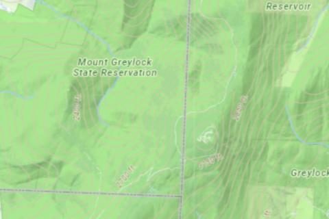
Statewide general-reference base map with shaded relief, contours, water, wetlands, protected open space, roads and boundaries, cached to zoom 23.
How to add this service
- MassGIS Basemap:
https://tiles.arcgis.com/tiles/hGdibHYSPO59RG1h/arcgis/rest/services/MassGISBasemap/MapServer/tile/{z}/{y}/{x}
- MassGIS Basemap Detailed Features:
https://tiles.arcgis.com/tiles/hGdibHYSPO59RG1h/arcgis/rest/services/MassGIS_Basemap_Detailed_Features/MapServer/tile/{z}/{y}/{x}
Report a problem with this entry
MassGIS topographic features
MassGIS (Bureau of Geographic Information), Commonwealth of Massachusetts · XYZ · Free · Public records, attribution requested · Service page · MassGIS Base Map
The topographic layer of the MassGIS base map on its own: shaded relief, contours, water bodies, wetlands and protected open space.
How to add this service
- Topographic Features for Basemap:
https://tiles.arcgis.com/tiles/hGdibHYSPO59RG1h/arcgis/rest/services/MassGIS_Topographic_Features_for_Basemap/MapServer/tile/{z}/{y}/{x}
Report a problem with this entry
MassGIS topo base with parcels
MassGIS (Bureau of Geographic Information), Commonwealth of Massachusetts · XYZ · Free · Public records, attribution requested · Service page
The topographic base map with detailed features and tax parcels, which appear at zooms 17 to 19.
How to add this service
- Topo Detailed with parcels:
https://tiles.arcgis.com/tiles/hGdibHYSPO59RG1h/arcgis/rest/services/MassGISBasemap_Topo_Detailed_L3/MapServer/tile/{z}/{y}/{x}
Report a problem with this entry
MassGIS USGS topographic quads
MassGIS (Bureau of Geographic Information), Commonwealth of Massachusetts; source maps USGS · XYZ · Free · Public records, attribution requested · MassGIS USGS quads · Service page
Seamless scanned USGS quads of Massachusetts (15-minute 1982–1990 where available, otherwise 7.5-minute 1967–1979), as tiles, or as 4 km TIFF tiles to download.
How to add this service
- For files, open the USGS Topographic Quadrangle Images page, click the MassMapper download link and pick TIFF tiles from the download grid.
- USGS Topo Quad Maps:
https://tiles.arcgis.com/tiles/hGdibHYSPO59RG1h/arcgis/rest/services/USGS_Topo_Quad_Maps/MapServer/tile/{z}/{y}/{x}
Report a problem with this entry
MassGIS LiDAR shaded relief
MassGIS (Bureau of Geographic Information), Commonwealth of Massachusetts · XYZ · Free · Public records, attribution requested · Service page
Hillshade rendered from the LiDAR bare-earth elevation model.
How to add this service
- LiDAR shaded relief:
https://tiles.arcgis.com/tiles/hGdibHYSPO59RG1h/arcgis/rest/services/LiDAR_ShadedRelief/MapServer/tile/{z}/{y}/{x}
Report a problem with this entry
Massachusetts aerial imagery 2025
MassGIS (Bureau of Geographic Information), Commonwealth of Massachusetts · XYZ · Free · Public records, attribution requested · Service page
Spring 2025 leaf-off true-colour aerial imagery of the state; the 2023 imagery is on the second address.
How to add this service
- Aerial imagery spring 2025:
https://tiles.arcgis.com/tiles/hGdibHYSPO59RG1h/arcgis/rest/services/Massachusetts_Aerial_Imagery_2025/MapServer/tile/{z}/{y}/{x}
- Orthos 2023:
https://tiles.arcgis.com/tiles/hGdibHYSPO59RG1h/arcgis/rest/services/orthos2023/MapServer/tile/{z}/{y}/{x}
Report a problem with this entry
Michigan
1 file source, 1 service
Michigan statewide imagery
State of Michigan (imagery.michigan.gov, Michigan Statewide Authoritative Imagery and LiDAR program) · XYZ, WMS · Free · Terms not stated · Service page
Statewide colour aerial imagery cached to zoom 19, with a colour-infrared version on the third address.
How to add this service
- Tiles:
https://imagery.michigan.gov/server/rest/services/Michigan_imagery_public/MapServer/tile/{z}/{y}/{x}
- WMS:
https://imagery.michigan.gov/server/services/Michigan_imagery_public/MapServer/WMSServer
- Colour infrared tiles:
https://imagery.michigan.gov/server/rest/services/Michigan_imagery_CIR_public/MapServer/tile/{z}/{y}/{x}
The service does not state the imagery year.
Report a problem with this entry
Michigan DNR snowmobile trail maps
Michigan Department of Natural Resources (DNR) · GeoPDF · Free · Terms not stated · Where to snowmobile · Snowmobile maps in list format
Snowmobile trail maps by region and county as geospatial PDFs, with GPX and KML on the same page.
How to download
- Open Snowmobile maps in list format.
- Download the regional or county PDF.
The page is marked as archived content, so check each map's date.
Report a problem with this entry
Minnesota
2 file sources, 2 services
Minnesota DNR Mobile Maps
Minnesota Department of Natural Resources · GeoPDF · Free · MNDNR copyright, reference use · Mobile Maps
More than 800 Minnesota DNR recreation maps as GeoPDFs: state parks, state forests, trails, OHV areas, hunter walking trails, trout streams and water trails.
How to download
- Open Mobile Maps and agree to the terms.
- Filter by map topic or name, or click the map to list the maps that cover that spot.
- Click Download beside the map; the GeoPDF opens in a new tab, where you save it.
99 state parks, 34 state forests, 40 state trails, 85 OHV areas and 305 hunter walking trails. Files are named <map> GEO.pdf.
Report a problem with this entry
MnGeo Composite Image Service
MnGeo (Minnesota Geospatial Information Office) · WMS · Free · Terms not stated · Composite Image Service page · MnGeo WMS index · Geospatial Commons record
Statewide WMS that shows Landsat imagery when zoomed out and 2023 FSA/NAIP 0.3 m air photos when zoomed in.
How to add this service
- Composite Image Service WMS:
https://imageserver.gisdata.mn.gov/cgi-bin/mncomp?
- GetCapabilities:
https://imageserver.gisdata.mn.gov/cgi-bin/mncomp?VERSION=1.3.0&SERVICE=WMS&REQUEST=GetCapabilities
Layers landsat, fsa2023 and fsa2008.
Report a problem with this entry
Minnesota Geospatial Image Service
MnGeo (Minnesota Geospatial Information Office) · WMS · Free · Terms not stated · MnGeo WMS index · Geospatial Image Service page · Hillshade record
WMS with air photos, the statewide LiDAR hillshade and topographic maps as seamless layers.
How to add this service
- Geospatial Image Service WMS:
https://imageserver.gisdata.mn.gov/cgi-bin/wms?VERSION=1.3.0&SERVICE=WMS&REQUEST=GetCapabilities
- Alternate service URL listed on the Commons:
https://imageserver.gisdata.mn.gov/cgi-bin/wmswm?
- Hillshade zip download:
https://operations.gis.data.mn.gov/api/publicdownload/download/460/elev_lidar_hillshade.zip
Report a problem with this entry
Minnesota USNG 10K reference maps
Dakota County (published through the Minnesota Geospatial Commons) · GeoPDF · Free · Terms not stated · Commons record · USNG 10K Reference Maps web app
Emergency-management reference maps on the 10 km US National Grid, with roads, boundaries and public facilities over a street or aerial background, downloadable as GeoPDF by grid cell.
How to download
- Open the USNG 10K Reference Maps app, zoom to your area and click the grid cell.
- Use the pop-up link to download that cell's GeoPDF.
Report a problem with this entry
Mississippi
1 service
Mississippi LiDAR hillshade
MARIS · WMS · Free · Terms not stated · MARIS map services
Grey shaded relief of Mississippi from the statewide LiDAR mosaic, as WMS.
How to add this service
- Mississippi LiDAR shaded terrain WMS:
https://gis.mississippi.edu/server/services/Elevation/LIDAR_Statewide_Grey/MapServer/WMSServer
Layer 1.
Report a problem with this entry
Montana
1 file source
Continental Divide Trail section maps
Continental Divide Trail Coalition · GeoPDF · Free · Terms not stated · How to download the section maps · CDT Interactive Map
The coalition's Version 4.0 map set at half a mile to the inch, built on Forest Service data, with land ownership and an elevation profile; one page per PDF, in high or low resolution. The pages don't say so, but the PDFs are georeferenced.
How to download
- Open the CDT Interactive Map, preferably on a computer.
- Tap Layers, find Mapset Pages and tap its eye icon to show the purple page outlines.
- Tap the outline for your section and, under Download Version 4.0, choose High Resolution or Low Resolution. The PDF opens on Dropbox; tap the download icon to save it.
Report a problem with this entry
Nevada
1 file source
Nevada OHV trail maps
Nevada Off-Highway Vehicle Program · GeoPDF · Free · Terms not stated · Example: Dixie Valley · Nevada OHV Program
OHV trail maps of riding areas such as Dixie Valley, the Pine Nuts and Sand Mountain, as GeoPDFs of 6 to 15 MB.
How to download
- Download a map from ohv.nv.gov/assets/etc/pdfs/, for example
DixieValleyV2.pdf; the program's site points to Nevada Trail Finder and does not link the files.
Files seen include PineNutsV2.pdf, SandMountainV2.pdf, DunGlenV2.pdf and GraniteRangeV2.pdf.
Report a problem with this entry
New Hampshire
1 file source
Belknap Range trail map
Belknap Range Trail Tenders (belknaprangetrails.org) · GeoPDF · Free · Terms not stated · Belknap Range Trail Map
The Belknap Range Trail Tenders' two-sided hiking map of the range (2022 edition), posted as a georeferenced PDF.
How to download
- Open the Belknap Range Trail Map page and click Download Map.
Report a problem with this entry
New Jersey
2 services
New Jersey orthoimagery
NJ Office of Information Technology, Office of GIS (NJOGIS) · XYZ · Free · Terms not stated · Service page
Statewide natural-colour orthoimagery from 2020, cached in web mercator; the 2015 edition is on the second address.
How to add this service
- 2020 natural colour orthos:
https://maps.nj.gov/arcgis/rest/services/Basemap/Orthos_Natural_2020_NJ_WM/MapServer/tile/{z}/{y}/{x}
- 2015 natural colour orthos:
https://maps.nj.gov/arcgis/rest/services/Basemap/Orthos_Natural_2015_NJ_WM/MapServer/tile/{z}/{y}/{x}
Report a problem with this entry
NJ Imagery Warehouse
NJ Office of Information Technology, Office of GIS (NJOGIS) · WMS, GeoTIFF · Free · No access constraints · NJGIN Imagery Products page · Service page
New Jersey aerial imagery: 2019 as WMS, and other years back to the 1930s as GeoTIFF downloads.
How to add this service
- For WMS, use the Natural2019 address with layer
Natural2019.
- For files, open the NJGIN Imagery Products page, find the year in the Imagery Warehouse section and download the COG tiles.
- NJ 2019 natural colour imagery WMS:
https://img.nj.gov/imagerywms/Natural2019
- NJ 2012 natural colour imagery WMS:
https://img.nj.gov/imagerywms/Natural2012
- NJ 2012 infrared imagery WMS:
https://img.nj.gov/imagerywms/Infrared2012
Whole-state GeoTIFFs for 2020, 2015, 2012, 2007, 2002, 1977 and the 1930s are in the public njogis-imagery S3 bucket. WMS requests are capped at 3840 × 3840 pixels.
Report a problem with this entry
New Mexico
3 file sources
RGIS US Topo GeoTIFF quadrangles
Earth Data Analysis Center, University of New Mexico (RGIS / GSToRE) · GeoTIFF, WMS · Free · Terms not stated · RGIS data portal · RGIS FAQ
USGS US Topo 7.5-minute quadrangles of New Mexico (2011–2013 editions) as GeoTIFF, each also served as its own WMS.
How to download
- Open the RGIS data portal, filter to Rasters and search the quad name under Topographic Maps.
- Download the
.original.tif, or copy the dataset's WMS address.
- Example GeoTIFF: NM Abbott Lake, US Topo 2013:
https://gstore.unm.edu/apps/rgis/datasets/fbc6ca9e-eecd-41dd-86ac-febb7d7b7b18/NM_Abbott_Lake_20131205_TM_geo.original.tif
- Example WMS:
https://gstore.unm.edu/apps/rgis/datasets/bd795df2-fd3e-4b54-9bdb-4570b9dbe629/services/ogc/wms?SERVICE=wms&REQUEST=GetCapabilities&VERSION=1.1.1
- Search API:
https://gstore.unm.edu/apps/rgis/search/datasets.json?version=3&theme=Topographic+Maps&query=<quad name>
One WMS per quad, so a trip may need several.
Report a problem with this entry
New Mexico land status maps
New Mexico State Land Office · GeoPDF · Free · Terms not stated · Printable Maps
Statewide maps of state trust land and federal surface ownership, January 2026, at 11 × 17 and 42 × 48 inches, published as GeoPDFs.
How to download
- Open Printable Maps on nmstatelands.org and download Land Status.
Report a problem with this entry
Continental Divide Trail section maps
Continental Divide Trail Coalition · GeoPDF · Free · Terms not stated · How to download the section maps · CDT Interactive Map
The coalition's Version 4.0 map set at half a mile to the inch, built on Forest Service data, with land ownership and an elevation profile; one page per PDF, in high or low resolution. The pages don't say so, but the PDFs are georeferenced.
How to download
- Open the CDT Interactive Map, preferably on a computer.
- Tap Layers, find Mapset Pages and tap its eye icon to show the purple page outlines.
- Tap the outline for your section and, under Download Version 4.0, choose High Resolution or Low Resolution. The PDF opens on Dropbox; tap the download icon to save it.
Report a problem with this entry
New York
2 file sources, 1 service, 1 paid
NYSDEC georeferenced trail maps
New York State Department of Environmental Conservation (NYSDEC) · GeoPDF · Free · Terms not stated · Georeferenced PDF Maps · Places to Go
Trail maps of individual DEC state forests, wildlife management areas and other lands, posted as GeoPDFs on each property's page.
How to download
- Open DEC's Places to Go and find the property.
- In its Maps section, download the map tagged (GeoPDF); not every property has one.
Report a problem with this entry
New York State orthoimagery
NYS ITS Geospatial Services (NYS GIS Program Office), orthoimagery program · WMS · Free · Terms not stated · NYS Orthoimagery program · Service page
Statewide orthoimagery as WMS: a latest mosaic from 2022 to 2025 at about 12 inch, and a separate service for each year from 2000.
How to add this service
- For another year, replace
Latest in the address with the year.
- Latest:
https://orthos.its.ny.gov/arcgis/services/wms/Latest/MapServer/WMSServer
Layers in the Latest service are named by year: 2022, 2023, 2024, 2025.
Report a problem with this entry
Finger Lakes Trail digital maps
Finger Lakes Trail Conference · GeoPDF · Paid, $3.00 to $5.00 a map · Terms not stated · Maps and GPS
The conference's 66 trail maps as downloads: each ZIP holds a two-page PDF, the georeferenced map and the trail description, and a GPX file. A free sample map is on the same page.
How to buy
- Open Maps and GPS, choose maps from the index or the single-map list and buy the digital files.
- Download each ZIP from the link shown after checkout (the links expire after five days) and unzip it.
Report a problem with this entry
North Carolina
4 file sources, 2 services, 1 paid
NC OneMap latest orthoimagery
NC Center for Geographic Information and Analysis (NC OneMap) · XYZ · Free · Terms not stated · Service page
North Carolina's most recent statewide orthoimagery, cached to zoom 23.
How to add this service
- Latest orthoimagery tiles:
https://services.nconemap.gov/secure/rest/services/Imagery/Orthoimagery_Latest_cached/ImageServer/tile/{z}/{y}/{x}
Report a problem with this entry
NC OneMap LiDAR hillshade
NC Center for Geographic Information and Analysis (NC OneMap) · WMS · Free · NC OneMap terms · Service page
Hillshade of North Carolina from the statewide 3 m LiDAR elevation model, as WMS.
How to add this service
- DEM03 hillshade WMS:
https://services.nconemap.gov/secure/services/Elevation/DEM03_hillshade/ImageServer/WMSServer
Layer 0.
Report a problem with this entry
NC Wildlife Resources Commission game land maps
North Carolina Wildlife Resources Commission · GeoPDF · Free · Terms not stated · Game Lands Maps · Mountain region game land PDF maps · Piedmont region game land PDF maps
A map of each game land with boundaries, roads, trails and access points; the commission says the PDFs are georeferenced.
How to download
- Open the Game Lands Maps page and choose the Mountain, Piedmont or Coastal region.
- Click the game land's name to download its PDF.
KMZ boundary files are on the same pages.
Report a problem with this entry
outrageGIS Great Smoky Mountains GeoPDF pack
outrageGIS mapping · GeoPDF · Paid, $20 for the pack · Terms not stated · GPS and GeoPDF Pack
Two 1:50,000 GeoPDFs of the park with 100 ft contours, a UTM grid and the backcountry campsites, plus GPX files, as one 250 MB download.
How to buy
- Buy the pack, download it and unzip it.
Report a problem with this entry
Great Smoky Mountains trail and area maps
National Park Service · GeoPDF · Free · US government work · Maps
The park's trail map, with trails, distances, backcountry campsites and shelters, and its area map; the page says both are GPS-enabled for mapping apps.
How to download
- Open the park's Maps page and tap Trail Map or Area Map.
Report a problem with this entry
Great Smoky Mountains topographic maps
National Park Service · GeoPDF · Free · US government work · Mobile Topographic Maps · Data Store collection
The park's 1:24,000 topographic quadrangles with trails, backcountry campsites, grid ticks and contours.
How to download
- Open the Data Store collection, tap the number in the File Count column beside a quadrangle and download the file described as GeoPDF.
Report a problem with this entry
North Dakota
2 services
North Dakota general base map
North Dakota GIS Hub (State of North Dakota) · XYZ · Free · Terms not stated · Service page
Statewide reference base map with roads, boundaries, hydrography and places, cached to zoom 23.
How to add this service
- Basemap_General tiles:
https://ndgishub.nd.gov/arcgis/rest/services/Basemap_General/MapServer/tile/{z}/{y}/{x}
Tiles outside North Dakota are empty.
Report a problem with this entry
North Dakota aerial imagery
North Dakota GIS Hub (State of North Dakota) · XYZ · Free · Terms not stated · Service page
Statewide aerial photography, cached to zoom 22.
How to add this service
- Basemap_Imagery tiles:
https://ndgishub.nd.gov/arcgis/rest/services/Basemap_Imagery/MapServer/tile/{z}/{y}/{x}
Report a problem with this entry
Ohio
1 file source
OSIP orthoimagery
Ohio Geographically Referenced Information Program (OGRIP), Ohio Department of Administrative Services · GeoTIFF · Free · Public use, at the user's risk · Geodata Download application · OSIP program page · OGRIP home
Ohio's statewide aerial orthoimagery as GeoTIFF tiles (6 in, 1 ft and 3 in) and county mosaics.
How to download
- Open the Geodata Download app and click a county.
- Zoom in and click a tile, or drag a rectangle, to get its GeoTIFF download links.
Prefer the 6IN GeoTIFF (standard) tiles; the 4-band tiles carry an infrared band.
Report a problem with this entry
Oklahoma
1 file source
Oklahoma WMA atlas maps
Oklahoma Department of Wildlife Conservation · PDF · Free · All rights reserved · WMA Maps
The pages of ODWC's wildlife management area atlas, one PDF per area (2018 to 2022), published as GeoPDFs although the page does not say so.
How to download
- Open the WMA Maps page and click the area; the legends are separate PDFs at the top of the list.
Report a problem with this entry
Oregon
3 file sources, 1 service
ODFW Access & Habitat and Travel Management Area maps
Oregon Department of Fish and Wildlife · GeoPDF · Free · Terms not stated · Hunting maps · Access & Habitat maps
Hunting access and travel-management maps for about 65 areas, showing open and closed roads and access boundaries; ODFW says these maps are now GeoPDFs.
How to download
- Open the ODFW hunting maps page and scroll to the Travel Management Area or Access & Habitat maps.
- Click the area name to download its PDF.
Larger areas are split into one file per page.
Report a problem with this entry
ODFW unit and controlled hunt maps
Oregon Department of Fish and Wildlife (ODFW) · GeoPDF · Free · Terms not stated · ODFW Maps
Wildlife management unit and controlled-hunt maps for Oregon, published as GeoPDFs although the pages do not say so.
How to download
- Open the ODFW Maps page and pick a unit.
- On the unit page, open the unit map or a controlled hunt map.
Report a problem with this entry
DOGAMI lidar hillshade
Oregon Department of Geology and Mineral Industries · WMS · Free · Terms not stated · Service page
Hillshade of Oregon's statewide bare-earth lidar mosaic at 3 ft, as WMS.
How to add this service
- Bare-earth hillshade:
https://gis.dogami.oregon.gov/arcgis/services/lidar/DIGITAL_TERRAIN_MODEL_MOSAIC_HS/ImageServer/WMSServer
Layer DIGITAL_TERRAIN_MODEL_MOSAIC_HS. The service does not list web mercator but draws in it.
Report a problem with this entry
Tillamook State Forest OHV map
Oregon Department of Forestry · GeoPDF · Free · Terms not stated · ODF motorized trails page · Georeferenced OHV trail map · Map side only
ODF's OHV trail map of the Tillamook State Forest (October 2018 edition) in a georeferenced version, with GPX tracks per trail class on the same page.
How to download
- Open the ODF motorized trails page.
- Download the file labelled Georeferenced Only; the 2019 map-side and text-side PDFs are not georeferenced.
Report a problem with this entry
Pennsylvania
2 file sources, 1 service
Pennsylvania 2021–2023 orthoimagery
Pennsylvania Spatial Data Access (PASDA), Penn State, hosting PEMA imagery · XYZ, WMS · Free · Terms not stated · Service page · imagery.pasda.psu.edu services root · PASDA home
PEMA statewide aerial imagery from 2021 to 2023, cached to zoom 23 on PASDA.
How to add this service
- PEMA 2021-2023 imagery tiles:
https://imagery.pasda.psu.edu/arcgis/rest/services/PEMAImagery2021_2023cache/MapServer/tile/{z}/{y}/{x}
- WMS:
https://imagery.pasda.psu.edu/arcgis/services/PEMAImagery2021_2023cache/MapServer/WMSServer?request=GetCapabilities&service=WMS
Report a problem with this entry
PASDA GeoPDF folders
Pennsylvania Spatial Data Access (PASDA), Penn State (USGS products) · GeoPDF · Free · Public domain · PASDA download root · Service page
A plain directory of USGS GeoPDF quads mirrored by PASDA: US Topo editions by year and historic quads by state.
How to download
- Open the PASDA download root.
- Browse into GeoPDF/<year>/ or GeoPDF_topo/<state>/ and click a quad to download.
Report a problem with this entry
DCNR state forest trail maps
Pennsylvania Department of Conservation and Natural Resources (DCNR), Bureau of Forestry · GeoPDF · Free · Terms not stated · Example: Elk State Forest maps
Georeferenced PDF maps of hiking, equestrian and water trails in Pennsylvania's state forests, such as the Quehanna Trail and Bucktail Path.
How to download
- Open the state forest's page on pa.gov and click Maps.
- Scroll to Georeferenced Hiking Trail Maps and download the trail.
The whole-forest public use maps are not georeferenced.
Report a problem with this entry
Rhode Island
1 service
RIGIS orthoimagery
Rhode Island Geographic Information System (RIGIS), University of Rhode Island Environmental Data Center · WMS · Free · Terms not stated · Service page
Statewide 3-inch orthoimagery of Rhode Island from spring 2025 as WMS, with flights for every year since 2018 in the same folder.
How to add this service
- Open the RIGIS IMG folder and pick the year with the
_web suffix.
- Use
https://maps.edc.uri.edu/rigis/services/IMG/<service name>/ImageServer/WMSServer with the layer named after the service.
- Spring 2025 3-inch orthos WMS:
https://maps.edc.uri.edu/rigis/services/IMG/RI_202504_RGB_3in_web/ImageServer/WMSServer
- Spring 2020 6-inch 4-band orthos WMS:
https://maps.edc.uri.edu/rigis/services/IMG/RI_202004_RGBI_6in_web/ImageServer/WMSServer
Report a problem with this entry
South Carolina
1 service
South Carolina 2023 imagery
South Carolina Revenue and Fiscal Affairs Office · XYZ · Free · Terms not stated · Service page
Statewide 6-inch leaf-off aerial imagery, cached to zoom 20.
How to add this service
- SC 2023 RGB imagery tiles:
https://tiles.arcgis.com/tiles/RvqSyw3diI7dTKo5/arcgis/rest/services/SC_2023_RGB/MapServer/tile/{z}/{y}/{x}
Report a problem with this entry
Tennessee
4 file sources, 1 service, 1 paid
TNMap orthoimagery
State of Tennessee (TNMap) · XYZ · Free · Terms not stated · Service page
TDOT orthoimagery of Tennessee, 6-inch from 2022 on and 1 ft before, cached to zoom 23.
How to add this service
- TDOT imagery tiles:
https://tnmap.tn.gov/arcgis/rest/services/BASEMAPS/IMAGERY_WEB_MERCATOR/MapServer/tile/{z}/{y}/{x}
Report a problem with this entry
outrageGIS Great Smoky Mountains GeoPDF pack
outrageGIS mapping · GeoPDF · Paid, $20 for the pack · Terms not stated · GPS and GeoPDF Pack
Two 1:50,000 GeoPDFs of the park with 100 ft contours, a UTM grid and the backcountry campsites, plus GPX files, as one 250 MB download.
How to buy
- Buy the pack, download it and unzip it.
Report a problem with this entry
Fall Creek Falls State Park huntable lands map
Tennessee State Parks · GeoPDF · Free · Terms not stated · Fall Creek Falls State Park
Tennessee State Parks' 2026 map of the huntable lands at Fall Creek Falls, posted as a georeferenced PDF.
How to download
- Open the Fall Creek Falls State Park page and scroll to the maps list.
- Click Offline-Use GPS Map Huntable Lands to download the PDF.
Report a problem with this entry
Great Smoky Mountains trail and area maps
National Park Service · GeoPDF · Free · US government work · Maps
The park's trail map, with trails, distances, backcountry campsites and shelters, and its area map; the page says both are GPS-enabled for mapping apps.
How to download
- Open the park's Maps page and tap Trail Map or Area Map.
Report a problem with this entry
Great Smoky Mountains topographic maps
National Park Service · GeoPDF · Free · US government work · Mobile Topographic Maps · Data Store collection
The park's 1:24,000 topographic quadrangles with trails, backcountry campsites, grid ticks and contours.
How to download
- Open the Data Store collection, tap the number in the File Count column beside a quadrangle and download the file described as GeoPDF.
Report a problem with this entry
Texas
1 service
TxGIO NAIP imagery
Texas Geographic Information Office (TxGIO, formerly TNRIS) · WMS, GeoTIFF · Free · CC0 1.0 · TxGIO DataHub catalogue API · Service page · TxGIO DataHub
Statewide NAIP orthoimagery for 2004 to 2022 as WMS, and NAIP GeoTIFF tiles for some years from the TxGIO DataHub.
How to add this service
- For WMS, pick a year from the NAIP folder of the imagery REST directory and use its WMSServer address (layer
0).
- For files, open the DataHub, search NAIP 2016, choose your county or quad and download the TIFF tiles.
- NAIP 2022 60 cm WMS:
https://imagery.geographic.texas.gov/server/services/NAIP/NAIP22_NCCIR_60cm/ImageServer/WMSServer
- NAIP 2020 60 cm WMS:
https://imagery.geographic.texas.gov/server/services/NAIP/NAIP20_NCCIR_60cm/ImageServer/WMSServer
- NAIP 2016 1 m WMS:
https://imagery.geographic.texas.gov/server/services/NAIP/NAIP16_NCCIR_1m/ImageServer/WMSServer
- NAIP 2012 1 m WMS:
https://imagery.geographic.texas.gov/server/services/NAIP/NAIP12_NCCIR_1m/ImageServer/WMSServer
- NAIP 2004 CIR 1 m WMS:
https://imagery.geographic.texas.gov/server/services/NAIP/NAIP04_CIR_1m/ImageServer/WMSServer
Report a problem with this entry
Utah
1 file source, 1 service
UGRC Discover base maps and imagery
Utah Geospatial Resource Center (UGRC) · XYZ, WMS · Free · Free after registration · Discover product page · Discover client guides · General-access registration form
Utah's cached base maps and NAIP and HRO imagery as web mercator tiles for registered users; the key is a "quad word" that goes in the address.
How to add this service
- Fill in the Discover registration form; UGRC emails a quad word and the service addresses.
- Put the quad word in the address, for example
https://discover.agrc.utah.gov/login/path/<quad-word>/tiles/lite_basemap/{z}/{x}/{y}.
- Lite base map:
https://discover.agrc.utah.gov/login/path/<quad-word>/tiles/lite_basemap/{z}/{x}/{y}
Most layers stop at zoom 19. The latest statewide high-resolution imagery needs a signed licence agreement.
Report a problem with this entry
Utah trust lands ownership maps
Utah Trust Lands Administration · GeoPDF · Free · Reference use only · PDF ownership maps
Land ownership maps of Utah, statewide and one 11 × 17 sheet per county, published as GeoPDFs.
How to download
- Open Download PDF Ownership Maps on trustlands.utah.gov and pick the statewide or county map.
Report a problem with this entry
Vermont
5 services
VCGI Vermont base map
Vermont Center for Geographic Information (VCGI) · XYZ · Free · Terms not stated · Service page
Statewide base map with roads, towns, boundaries, water, buildings and contours.
How to add this service
- VCGI Basemap:
https://maps.vcgi.vermont.gov/arcgis/rest/services/VCGI_services/VCGI_BASEMAP_WM_CACHE_v2/MapServer/tile/{z}/{y}/{x}
Report a problem with this entry
VCGI hillshade plus contours
Vermont Center for Geographic Information (VCGI) · XYZ · Free · Terms not stated · Service page
10 m hillshade with contours, lakes, rivers and streams; the contours alone are on the second address.
How to add this service
- Hillshade plus contours and hydrography:
https://maps.vcgi.vermont.gov/arcgis/rest/services/EGC_services/MAP_VCGI_HILLSHDPLUS_WM_CACHE/MapServer/tile/{z}/{y}/{x}
- Contours only:
https://maps.vcgi.vermont.gov/arcgis/rest/services/EGC_services/MAP_VCGI_CONTOURS_WM_CACHE/MapServer/tile/{z}/{y}/{x}
Report a problem with this entry
Vermont LiDAR hillshade
Vermont Center for Geographic Information (VCGI) · XYZ · Free · Terms not stated · Service page
Hillshade from the 2023 statewide QL1 LiDAR: bare earth on the first address, surface on the second.
How to add this service
- Lidar DEM hillshade 2023:
https://maps.vcgi.vermont.gov/arcgis/rest/services/EGC_services/IMG_VCGI_LIDARHILLSHD_WM_CACHE_v1/ImageServer/tile/{z}/{y}/{x}
- Lidar DSM hillshade:
https://maps.vcgi.vermont.gov/arcgis/rest/services/EGC_services/IMG_VCGI_LIDARDSMHILLSHD_WM_CACHE_v1/ImageServer/tile/{z}/{y}/{x}
Report a problem with this entry
Vermont best-of-colour imagery
Vermont Center for Geographic Information (VCGI) · XYZ · Free · Terms not stated · Service page · VCGI Imagery Program
VCGI's most recent colour orthoimagery mosaic, cached to about zoom 21; the 2024 flight alone is on the second address.
How to add this service
- Best of Color imagery:
https://maps.vcgi.vermont.gov/arcgis/rest/services/EGC_services/IMG_VCGI_CLR_WM_CACHE/ImageServer/tile/{z}/{y}/{x}
- 2024 colour imagery:
https://maps.vcgi.vermont.gov/arcgis/rest/services/EGC_services/IMG_VCGI_CLR2024_WM_CACHE/ImageServer/tile/{z}/{y}/{x}
Report a problem with this entry
Vermont ANR Atlas base map
Vermont Agency of Natural Resources (ANR) · XYZ · Free · Terms not stated · Service page
Line-work base map of roads, rail, water, town and county boundaries and parcels, as used in the ANR Natural Resources Atlas.
How to add this service
- ANR basemap:
https://anrmaps.vermont.gov/arcgis/rest/services/map_services/MAP_ANR_ANRBASEMAP_WM_CACHE/MapServer/tile/{z}/{y}/{x}
Report a problem with this entry
Virginia
1 file source, 1 service
Virginia State Parks trail guides
Virginia Department of Conservation and Recreation - Virginia State Parks · GeoPDF · Free · Terms not stated · Park Trail Maps · Example: Grayson Highlands
A georeferenced PDF trail guide for every state park, showing trails with mileage, difficulty and blaze colour, facilities and the park boundary.
How to download
- Open the Park Trail Maps page.
- Find the park in the table and click the link in the Geo-referenced PDFs column.
Report a problem with this entry
VBMP most recent imagery
Virginia Geographic Information Network (VGIN), Virginia Department of Emergency Management · XYZ · Free · Terms not stated · Service page
Virginia's most recent statewide orthoimagery (2021 to 2023 flights), cached to zoom 23.
How to add this service
- VBMP most recent imagery:
https://vginmaps.vdem.virginia.gov/arcgis/rest/services/VBMP_Imagery/MostRecentImagery_WGS/MapServer/tile/{z}/{y}/{x}
Report a problem with this entry
Washington
4 file sources, 1 service
Washington DNR mobile maps
Washington State Department of Natural Resources · GeoPDF · Free · Terms not stated · Mobile Maps
Fifty-five DNR recreation and green-dot road maps as PDFs that DNR says work with a phone's GPS offline.
How to download
- Open the DNR Mobile Maps page.
- Click the map name to download the PDF.
The page says "geolocated" rather than GeoPDF.
Report a problem with this entry
WSDOT Washington base map
Washington State Department of Transportation · XYZ · Free · Terms not stated · Service page
WSDOT's statewide road base map with state highways and local roads, cached to zoom 23.
How to add this service
- WSDOT base map:
https://data.wsdot.wa.gov/arcgis/rest/services/Shared/WebBaseMapWebMercator/MapServer/tile/{z}/{y}/{x}
Report a problem with this entry
Capitol State Forest map
Friends of Capitol Forest · GeoPDF · Free · Terms not stated · Map download page
The official DNR Capitol Forest trail and road map, posted by Friends of Capitol Forest as a georeferenced PDF.
How to download
- Open the map download page and follow the download link.
Report a problem with this entry
WDFW Columbia Basin regulated access area maps
Washington Department of Fish and Wildlife · GeoPDF · Free · Terms not stated · Georeferenced PDFs
Four 2021 waterfowl regulated-access-area maps for the Columbia Basin Wildlife Area, posted as georeferenced PDFs.
How to download
- Open the WDFW georeferenced PDFs page and download the map you want.
Report a problem with this entry
Vashon Island maps
Stefan Freelan Cartography · GeoPDF · Free · Terms not stated · Vashon maps · About the geo-enabled PDFs
Six 11 × 17 reference maps of Vashon Island (roads and parks, 20 ft contours, bike routes and others) by cartographer Stefan Freelan, posted as georeferenced PDFs.
How to download
- Open the Vashon maps page; the maps marked with an asterisk are georeferenced.
- Click the PDF link to download.
The 2023 topography and bathymetry map is not georeferenced.
Report a problem with this entry
West Virginia
2 file sources, 1 service
WVDOT county highway maps
West Virginia Department of Transportation, Information Technology Division (Mapping Service Unit) · GeoTIFF, GeoPDF · Free · Terms not stated · WVDOT GIS County Maps selection page · GIS County General Highway Maps · Example PDF: Hampshire County sheet 1
County general highway maps at 1 inch to the mile with roads by surface type, trails, public lands and hydrography, as GeoTIFF with or without hillshade.
How to download
- Open the WVDOT GIS County Maps page and click through to the map app.
- Zoom to the county, pick the sheet and choose the GeoTIFF download.
The PDF versions are not described as georeferenced.
Report a problem with this entry
West Virginia topographic base map and leaf-off imagery
West Virginia GIS Technical Center (WVU) · WMS · Free · Terms not stated · WVGISTC GIS Services list · Service page
WVGISTC's statewide topographic map (contours, streams, land cover and buildings over a hillshade) and 1 ft leaf-off imagery mosaic, as WMS.
How to add this service
- Open the mapwv.gov GIS Services page for the current service names.
- Use the WMS link on the service's MapServer page.
- Topographic basemap WMS:
https://services.wvgis.wvu.edu/arcgis/services/Imagery_BaseMaps_EarthCover/wv_basemap_WVGISTC_3D_elevation_contours/MapServer/WMSServer?request=GetCapabilities&service=WMS
- Leaf-off imagery WMS:
https://services.wvgis.wvu.edu/arcgis/services/Imagery_BaseMaps_EarthCover/wv_imagery_WVGISTC_leaf_off_mosaic/MapServer/WMSServer?request=GetCapabilities&service=WMS
The tile caches use a non-standard origin, so use WMS rather than the tile address.
Report a problem with this entry
WVDNR hunting and fishing map export
West Virginia Division of Natural Resources with WV GIS Technical Center · GeoPDF · Free · Terms not stated · WVDNR article on the online maps · WVDNR GIS & Mapping · Interactive map
The WVDNR interactive map of WMAs, public hunting land, fishing access and trout streams over topography.
How to download
- Open mapwv.gov/huntfish.
- Zoom to the area and use the print tool to save a PDF.
Report a problem with this entry
Wisconsin
2 file sources
Wisconsin DNR property maps
Wisconsin Department of Natural Resources (DNR) · GeoPDF · Free · Terms not stated · Example: Peninsula State Park maps
Summer, winter and bike trail maps of DNR properties, offered in a separate Georeferenced Property Maps (GeoPDF) section on each property's Maps page.
How to download
- Open the property's page on dnr.wisconsin.gov and click Maps.
- Under Georeferenced Property Maps (GeoPDF), click Download.
Report a problem with this entry
Ice Age Trail, Glacial Passage Area
National Park Service, Ice Age National Scenic Trail · GeoPDF · Free · Public domain · Ice Age National Scenic Trail maps
NPS GeoPDF of the Glacial Passage Area trails on the Ice Age National Scenic Trail, updated March 2026.
How to download
- Open the Ice Age National Scenic Trail maps page.
- Click Download a georeferenced PDF of the Glacial Passage Area.
Report a problem with this entry
Wyoming
5 file sources
Wyoming ORV area maps
Wyoming State Parks, Historic Sites & Trails (State Trails Program) · GeoPDF · Free · Terms not stated · ORV Maps page · Wyoming Trails Program
State Trails Program maps of designated ORV roads, trails and open riding areas by region, 2026 season, labelled GeoPDF.
How to download
- Open the ORV Maps page and scroll below the region map to the 2026 GeoPDFs.
- Click the area to download.
The files are large; the Bighorns sheet is about 257 MB.
Report a problem with this entry
Wyoming snowmobile area maps
Wyoming State Parks, Historic Sites & Trails (State Trails Program) · GeoPDF · Free · Terms not stated · Snowmobile Maps page · Older plain PDF example
Groomed snowmobile trail maps by region for the 2026 season, each labelled GeoPDF.
How to download
- Open the Snowmobile Maps page and scroll below the region overview.
- Click the area's 2026 Snowmobile - GeoPDF link to download.
Report a problem with this entry
Wyoming Game and Fish hunt area maps
Wyoming Game and Fish Department · GeoPDF · Free · Terms not stated · Hunt area map help
GeoPDFs of any area you choose, made with the Print to GeoPDF tool in Wyoming Game and Fish's Plan Your Hunt map.
How to download
- Open the Hunt Planner on wgfd.wyo.gov, pick a species and open the hunt area map.
- Zoom to your area, open the print tool and choose Print to GeoPDF.
Report a problem with this entry
Curt Gowdy State Park trail map
Wyoming State Parks · GeoPDF · Free · Terms not stated · Curt Gowdy State Park
The park's trail map, labelled GeoPDF on the park's page.
How to download
- Open the Curt Gowdy State Park page and click the link under New GEOpdf Now Available.
Report a problem with this entry
Continental Divide Trail section maps
Continental Divide Trail Coalition · GeoPDF · Free · Terms not stated · How to download the section maps · CDT Interactive Map
The coalition's Version 4.0 map set at half a mile to the inch, built on Forest Service data, with land ownership and an elevation profile; one page per PDF, in high or low resolution. The pages don't say so, but the PDFs are georeferenced.
How to download
- Open the CDT Interactive Map, preferably on a computer.
- Tap Layers, find Mapset Pages and tap its eye icon to show the purple page outlines.
- Tap the outline for your section and, under Download Version 4.0, choose High Resolution or Low Resolution. The PDF opens on Dropbox; tap the download icon to save it.
Report a problem with this entry
National Geographic's free Trails Illustrated PDF Quads are not georeferenced, and MyTopo prints custom maps but does not sell files. The Pacific Crest Trail has no georeferenced map set: Halfmile's free PDFs were withdrawn in 2019, and the Forest Service's ten PCT maps are sold on paper. The Appalachian Trail Conservancy, the Tahoe Rim Trail Association and the Pacific Northwest Trail Association sell printed maps.
Australia
Nationwide
AUSTopo and NATMAP 1:250,000 map sheets
Geoscience Australia · GeoPDF · Free · CC BY 4.0, commercial use allowed · Topographic maps
The national 1:250,000 series, 516 sheets with 50 m contours; AUSTopo is the current series from 2023, updated annually, and the older NATMAP sheets are on the same page.
How to download
- Open the 1:250,000 map index, tap the sheet outline and follow the download prompt; or search the sheet name in the GA catalogue and tap Download Map (GeoPDF).
Report a problem with this entry
Geoscience Australia topographic tile services
Geoscience Australia · XYZ · Free · CC BY 4.0, commercial use allowed
Two live national services: the Topographic Base Map in the 1:250,000 specification, which stops at zoom 12, and the scanned NATMAP 250K paper series as one seamless map.
How to add this service
- Topographic Base Map:
https://services.ga.gov.au/gis/rest/services/Topographic_Base_Map/MapServer/tile/{z}/{y}/{x}
- NATMAP 250K 2008:
https://services.ga.gov.au/gis/rest/services/NATMAP_Maps_250K_2008/MapServer/tile/{z}/{y}/{x}
Report a problem with this entry
Australian Capital Territory
1 service
ACT aerial imagery
ACT Government (ACTmapi) · XYZ · Free · CC BY 4.0 · Catalogue record
Current aerial imagery of the ACT, cached from zoom 8 to 21.
How to add this service
- ACT Aerial Imagery Current tiles:
https://tiles.arcgis.com/tiles/E5n4f1VY84i0xSjy/arcgis/rest/services/ACT_Aerial_Imagery_Current_3857/MapServer/tile/{z}/{y}/{x}
Report a problem with this entry
New South Wales
3 file sources, 3 services
New South Wales topographic maps
NSW Spatial Services · GeoPDF, XYZ · Free · CC BY 4.0, for the sheets; the tile service's record says Creative Commons without naming a version · Topographic maps
The state series at 1:25,000 in the east, 1:50,000 in the centre and 1:100,000 in the west, generated from current data, as GeoPDF sheets and as a seamless tile service.
How to download
- Sheets: in the NSW Topographic Map viewer, search a place or tap the map, select the sheet, open the details panel, find the year and tap more info to open the file. The sheets are full A1 maps.
- Tile service address:
https://maps.six.nsw.gov.au/arcgis/rest/services/public/NSW_Topo_Map/MapServer/tile/{z}/{y}/{x}
Report a problem with this entry
NSW Imagery
NSW Spatial Services (Department of Customer Service) · XYZ, WMS · Free · Creative Commons, version not stated · NSW Imagery Web Service GDA94 · Service page
Statewide aerial and satellite imagery, with the newest and highest-resolution imagery on top, cached to zoom 23.
How to add this service
- NSW Imagery tiles:
https://maps.six.nsw.gov.au/arcgis/rest/services/public/NSW_Imagery/MapServer/tile/{z}/{y}/{x}
- NSW Imagery WMS:
https://maps.six.nsw.gov.au/arcgis/services/public/NSW_Imagery/MapServer/WMSServer
Report a problem with this entry
NSW state forest hunting maps
NSW Department of Primary Industries (Game Licensing Unit) / Forestry Corporation of NSW · GeoPDF · Free · Terms not stated · Where can I hunt? · GPS download guides · Authorised hunting
Hunting boundary and exclusion zone maps for NSW state forests, for R-Licence holders through the Hunt NSW portal, updated about quarterly.
How to download
- Log in to the Hunt NSW portal with your R-Licence.
- Download the PDF map for the forest when you book, or from the public land hunting menu.
Report a problem with this entry
NSW historical topographic maps
NSW Spatial Services (Department of Customer Service) · XYZ · Free · Terms not stated · Service page
A mosaic of the state's 1:25,000, 1:50,000 and 1:100,000 topographic maps from 1970 to 1997, cached to zoom 21.
How to add this service
- NSW topo maps 1970-1997 tiles:
https://maps.six.nsw.gov.au/arcgis/rest/services/sixmaps/LPITopoMap_S1/MapServer/tile/{z}/{y}/{x}
Report a problem with this entry
Hume and Hovell Track maps
NSW Crown Lands · GeoPDF · Free · Terms not stated · Map Kits & Downloads
Five GeoPDF section maps of the 426 km walking track, with a GPX of the whole track on the same page.
How to download
- Open Map Kits & Downloads on humeandhovelltrack.com.au and download the section maps under Free GeoPDF Maps.
Report a problem with this entry
Sydney 1943 aerial imagery
NSW Spatial Services (Department of Customer Service) · XYZ · Free · Terms not stated · Service page
Greyscale aerial imagery of inner Sydney and the highways around 1943, cached to zoom 21.
How to add this service
- Sydney 1943 imagery tiles:
https://maps.six.nsw.gov.au/arcgis/rest/services/sixmaps/sydney1943/MapServer/tile/{z}/{y}/{x}
Report a problem with this entry
Queensland
1 file source, 7 services
Queensland topographic base map
Queensland Government · XYZ · Free · CC BY 4.0, commercial use allowed
The state topographic base map as a tile service, with shaded relief, refreshed every May and November.
How to add this service
- The QTopo site also prints map sheets as PDF, but does not say they are georeferenced.
- Address:
https://spatial-gis.information.qld.gov.au/arcgis/rest/services/Basemaps/QldMap_Topo/MapServer/tile/{z}/{y}/{x}
Report a problem with this entry
QldBase Colour
Queensland Government (Department of Natural Resources and Mines, Manufacturing and Regional and Rural Development) · XYZ · Free · Terms not stated · Service page
Queensland Government colour base map, cached to zoom 23 and updated each May and November.
How to add this service
- QldBase_Colour tiles:
https://spatial-gis.information.qld.gov.au/arcgis/rest/services/Basemaps/QldBase_Colour/MapServer/tile/{z}/{y}/{x}
Report a problem with this entry
QldBase Grey
Queensland Government (Department of Natural Resources and Mines, Manufacturing and Regional and Rural Development) · XYZ · Free · Terms not stated · Service page
Grey version of the Queensland base map, cached to zoom 23.
How to add this service
- QldBase_Grey tiles:
https://spatial-gis.information.qld.gov.au/arcgis/rest/services/Basemaps/QldBase_Grey/MapServer/tile/{z}/{y}/{x}
Report a problem with this entry
QldMap Lite
Queensland Government (Department of Natural Resources and Mines, Manufacturing and Regional and Rural Development) · XYZ · Free · Terms not stated · Service page
Light base map from Queensland foundation datasets, cached to zoom 23.
How to add this service
- QldMap_Lite tiles:
https://spatial-gis.information.qld.gov.au/arcgis/rest/services/Basemaps/QldMap_Lite/MapServer/tile/{z}/{y}/{x}
Report a problem with this entry
QldMap Relief
Queensland Government (Department of Natural Resources and Mines, Manufacturing and Regional and Rural Development) · XYZ · Free · Terms not stated · Service page
Shaded-relief base map of Queensland, cached to zoom 19.
How to add this service
- QldMap_Relief tiles:
https://spatial-gis.information.qld.gov.au/arcgis/rest/services/Basemaps/QldMap_Relief/MapServer/tile/{z}/{y}/{x}
Report a problem with this entry
Queensland latest imagery
Queensland Government (spatial-img.information.qld.gov.au) · XYZ, WMS · Free · Terms not stated · Service page
The latest Queensland state program aerial imagery with satellite fill, cached to zoom 20, also as WMS.
How to add this service
- Latest State Program imagery tiles:
https://spatial-img.information.qld.gov.au/arcgis/rest/services/Basemaps/LatestStateProgram_AllUsers/ImageServer/tile/{z}/{y}/{x}
- WMS:
https://spatial-img.information.qld.gov.au/arcgis/services/Basemaps/LatestStateProgram_AllUsers/ImageServer/WMSServer?request=GetCapabilities&service=WMS
Report a problem with this entry
QTopo 1:25,000 map sheets
Queensland Government · GeoPDF · Free · CC BY 4.0 · QTopo
Queensland's 1:25,000 topographic sheets, updated yearly, downloaded as PDFs from the QTopo application.
How to download
- Open QTopo and find the sheet for your area.
- Download the sheet's PDF.
Report a problem with this entry
Queensland earliest aerial imagery
Queensland Government (Department of Resources / spatial-img.information.qld.gov.au) · WMS · Free · CC BY · Service page
The oldest available aerial orthophotos for each part of Queensland, as WMS.
How to add this service
- Earliest aerial ortho WMS 1.3.0:
https://spatial-img.information.qld.gov.au/arcgis/services/Basemaps/EarliestAerialOrtho_AllUsers/ImageServer/WMSServer
Report a problem with this entry
South Australia
1 file source, 1 service
South Australian park maps
National Parks and Wildlife Service South Australia · GeoPDF · Free · CC BY 3.0 AU (site) · Maps
Park maps of South Australia's national and conservation parks, published as GeoPDFs on each park's Maps tab.
How to download
- Open the park's page on parks.sa.gov.au and choose the Maps tab.
- Download the park map.
Report a problem with this entry
Location SA topographic base map
Government of South Australia · XYZ · Free · Terms not stated
South Australia's topographic base map with trails, parks and contours, as cached tiles.
How to add this service
- Topographic_wmas tiles:
https://basemap.geohub.sa.gov.au/arcgis/rest/services/BaseMaps/Topographic_wmas/MapServer/tile/{z}/{y}/{x}
Report a problem with this entry
Tasmania
1 file source, 4 services, 1 paid
Tasmania: theLIST base maps
Land Tasmania · XYZ · Free · CC BY 3.0 AU, for the topographic base map, commercial use allowed; Tasmap 1:25,000 is CC BY-NC-ND 3.0 AU, personal use only
Two state services: the Topographic base map drawn from current vector data, and Tasmap 25K, the printed 1:25,000 series stitched into one map.
How to add this service
- Topographic:
https://services.thelist.tas.gov.au/arcgis/rest/services/Basemaps/Topographic/MapServer/tile/{z}/{y}/{x}
- Tasmap 25K:
https://services.thelist.tas.gov.au/arcgis/rest/services/Basemaps/Tasmap25K/MapServer/tile/{z}/{y}/{x}
Report a problem with this entry
TASMAP digital maps
Land Tasmania · GeoTIFF, GeoPDF · Paid, A$7.50 per 1:50,000 sheet, A$2.95 per 1:25,000 or 1:250,000 sheet · Non-commercial use, Copyright Act notice, no DRM · TASMAP shop
The state map series as plain files: each 1:50,000 sheet comes as GeoTIFF, GeoPDF and KMZ, and the archived 1:25,000 and the 1:250,000 sheets cost less. The shop also sells the walk maps as digital files, among them Cradle Mountain Lake St Clair for the Overland Track, Peninsula Walks for the Three Capes Track and South Coast Walks.
How to buy
- In the TASMAP shop, find the sheet, set Format to Digital and check out. Whole-state bundles: 1:100,000 for A$59.95, 1:25,000 for A$275, 1:50,000 for A$350.
Report a problem with this entry
Tasmania 1:50,000 emergency map book
Land Tasmania (theLIST) · XYZ · Free · LIST web services terms · Service page
The public version of the 1:50,000 map book used by Tasmania's emergency services, cached to zoom 15.
How to add this service
- ES map book tiles:
https://services.thelist.tas.gov.au/arcgis/rest/services/Basemaps/ESgisMapBookPUBLIC/MapServer/tile/{z}/{y}/{x}
Nothing draws below zoom 6 or above zoom 15.
Report a problem with this entry
Tasmania hillshade
Land Tasmania (theLIST) · XYZ · Free · CC BY 3.0 AU · Service page
Shaded relief of Tasmania from LiDAR and a 30 m elevation grid, cached to zoom 18.
How to add this service
- theLIST Hillshade tiles:
https://services.thelist.tas.gov.au/arcgis/rest/services/Basemaps/Hillshade/MapServer/tile/{z}/{y}/{x}
Report a problem with this entry
Launceston orthophotos
City of Launceston (Launceston City Council) · XYZ · Free · Terms not stated · Service page · JOSM Maps/Australia imagery list
10 cm aerial imagery of the Launceston urban area from February 2013, cached to zoom 20; the 2011 imagery is on the second address.
How to add this service
- Launceston orthophoto Feb 2013 10 cm:
https://mapping.launceston.tas.gov.au/arcgis/rest/services/Public/OrthoPhoto_Feb2013_10cm/MapServer/tile/{z}/{y}/{x}
- Launceston orthophoto Dec 2011 10 cm — from JOSM list, not verified:
https://mapping.launceston.tas.gov.au/arcgis/rest/services/Public/OrthoPhoto_Dec2011_10cm/MapServer/tile/{z}/{y}/{x}
- Launceston orthophoto Dec 2008 — from JOSM list, not verified:
https://mapping.launceston.tas.gov.au/arcgis/rest/services/Public/OrthoPhoto_Dec2008/MapServer/tile/{z}/{y}/{x}
Report a problem with this entry
Victoria
2 file sources, 2 paid
Vicmap Topographic Maps
Land Use Victoria · GeoPDF · Paid, A$3 to A$8.50 per map · Terms not stated on the product pages · Vicmap Topographic Maps Online · Products and schedule
Victoria's topographic map series as GeoPDFs: more than 10,000 sheets at 1:25,000, 1:50,000 and 1:100,000, plus custom maps.
How to buy
- In Vicmap Topographic Maps Online, find the map, add it to the cart and pay. A0 sheets run 1 to 40 MB.
Report a problem with this entry
Meridian Maps digital maps
Meridian Maps · GeoTIFF · Paid, A$10.95 to A$19.95 per map · Terms not stated · Meridian digital maps
Thirteen four-wheel-drive, touring and walking maps, mostly Victorian, sold as GeoTIFF downloads.
How to buy
- On the map's page, choose GeoTiff in the format selector and check out. A five-map Victorian 4WD pack is A$89.75.
Report a problem with this entry
Western Australia
2 services
Landgate Locate imagery
Landgate · WMS · Free · Terms not stated · Service page
Free statewide aerial imagery of Western Australia, as WMS.
How to add this service
- Locate imagery WMS 1.3.0:
https://services.slip.wa.gov.au/public/services/SLIP_Public_Services/Locate/MapServer/WMSServer
Layer 1.
Report a problem with this entry
WA 2 m and 10 m contours
Landgate (SLIP) · WMS · Free · Terms not stated · Service page
Contour overlay for Western Australia's south-west at 2 m and 10 m intervals, as WMS.
How to add this service
- SLIP Terrain WMS 1.3.0:
https://services.slip.wa.gov.au/public/services/SLIP_Public_Services/Terrain/MapServer/WMSServer
Layer 2 for 2 m contours, 1 for 10 m. They draw only when zoomed in.
Report a problem with this entry
Western Australia sells its topographic sheets as locked, print-only PDFs. The Bibbulmun Track Foundation and the Friends of the Heysen Trail sell printed maps, and the NSW government sells a paper map kit for the Great North Walk. The NT government's Larapinta Trail section maps are not georeferenced.
New Zealand
Nationwide
LINZ Basemaps: Topo50 and aerial imagery
Toitū Te Whenua Land Information New Zealand · XYZ · Free · CC BY 4.0, commercial use allowed · LINZ Basemaps
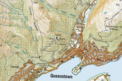
The Topo50 and Topo250 series as one seamless map, plus the national aerial imagery, with a free key that lasts 90 days.
How to add this service
- Open basemaps.linz.govt.nz, tap the menu in the top right, choose Topo Gridless Maps or Aerial Imagery under Layers, and under Individual API keys tap the copy button beside XYZ. The address carries your key:
https://basemaps.linz.govt.nz/v1/tiles/topo-raster/WebMercatorQuad/{z}/{x}/{y}.webp?api=…
- A key lasts 90 days; copy a new one when the tiles stop. If
.webp tiles do not draw, change the extension to .png.
Report a problem with this entry
Topo50 and Topo250 map sheets
Toitū Te Whenua Land Information New Zealand · GeoTIFF · Free · CC BY 4.0, commercial use allowed · Topo50 map chooser
The 451 Topo50 sheets at 1:50,000 and the 31 Topo250 sheets as GeoTIFFs of the map area without the legend; around 100 MB each.
How to download
- Find the sheet code on the Topo50 sheet index, open the sheet in the map chooser, and tap the GeoTIFF link marked Map area only. The TIFF with the legend is not georeferenced.
- The Topo250 chooser works the same way.
Report a problem with this entry
Topo50 cropped to your area
LINZ Data Service · GeoTIFF · Free · CC BY 4.0, commercial use allowed · NZ Topo50 Maps layer
The Topo50 maps on the LINZ Data Service, where a free account lets you crop a rectangle and export only that part as GeoTIFF.
How to download
- Sign in at data.linz.govt.nz, open the NZ Topo50 Maps layer, tap Crop and drag a rectangle, then Export, GeoTIFF, Create Export. The download is a zip.
Report a problem with this entry
Topo250 map sheets (GeoTIFF)
Toitū Te Whenua Land Information New Zealand · GeoTIFF · Free · CC BY 4.0 · Topo250 Map Chooser · Sheet index
The 1:250,000 topographic sheets as GeoTIFF in NZTM2000, map face only.
How to download
- Open the Topo250 Map Chooser and select the sheet.
- Choose the GeoTIFF download.
Report a problem with this entry
LINZ nautical chart GeoTIFFs
Toitū Te Whenua Land Information New Zealand · GeoTIFF · Free · Terms not stated · Where to find charts · LINZ Data Service
Raster images of the official New Zealand paper charts as GeoTIFF from the LINZ Data Service; LINZ says they are not for navigation.
How to download
- Sign in to the LINZ Data Service (free account), search the chart GeoTIFF layers and export.
Plain TIFF images of the same charts are on charts.linz.govt.nz.
Report a problem with this entry
The Topo50 and Topo250 series above are free. DOC's Great Walk brochure maps are not georeferenced; the Topo50 sheets above cover every Great Walk.
United Kingdom
Nationwide
OS Maps API, the Outdoor style
Ordnance Survey · XYZ · Free · OS OpenData, Open Government Licence, for the open zoom levels; the API terms on caching could not be read, so check them before a large offline download · OS Maps API · OS Data Hub
Ordnance Survey's own map tiles. The Outdoor, Road and Light styles are free from zoom 7 to 16 with a free key.
How to add this service
- Create a free account at osdatahub.os.uk on the OS OpenData plan, open API Projects, make a project and add OS Maps API; the project page shows the key.
- Address:
https://api.os.uk/maps/raster/v1/zxy/Outdoor_3857/{z}/{x}/{y}.png?key=YOURKEY. Zoom 17 and beyond is premium and charged. The API terms on caching could not be read; check them before a large offline download.
The Leisure style, which looks like the Explorer maps, is published only in British National Grid tiling, which TopoKit cannot stream.
Report a problem with this entry
OS OpenData raster maps: VectorMap District, OpenMap Local, 1:250,000
Ordnance Survey · GeoTIFF · Free · Open Government Licence, commercial use allowed · VectorMap District download · OpenMap Local download · 1:250,000 download
Ordnance Survey's free maps of Great Britain as GeoTIFF: VectorMap District, OpenMap Local and the 1:250,000 road map. None has the contours and footpaths of an Explorer map.
How to download
- Open the download page for the product, choose GeoTIFF and, for VectorMap District and OpenMap Local, the 100 km grid square (NN for Fort William, NY for the Lakes, SH for Snowdonia, TQ for London). A square is 100 to 1,100 MB and unzips to many tiles in British National Grid.
VectorMap District comes in 10 km tiles, OpenMap Local in 5 km tiles, and the 1:250,000 map as one 134 MB zip.
Report a problem with this entry
Historic Ordnance Survey maps
National Library of Scotland · XYZ · Free · CC BY 3.0 with conditions, personal use on the free MapTiler plan; the one-inch Seventh Series and 1:25,000 Provisional layers are restricted to non-commercial use · Historic Maps API
The library's georeferenced scans of the old OS series as tile layers, served through MapTiler with a free key that allows 100,000 tiles a month.
How to add this service
- Create a free account at cloud.maptiler.com and copy the key.
- Address:
https://api.maptiler.com/tiles/uk-osgb63k1955/{z}/{x}/{y}.jpg?key=YOURKEY for the one-inch Seventh Series; uk-osgb10k1888 is the six-inch maps, uk-osgb25k1937 the 1:25,000 Provisional edition.
Report a problem with this entry
BGS geology at 1:50,000
British Geological Survey · WMS · Free · Open Government Licence, commercial use allowed
Bedrock and superficial geology for all of Great Britain, drawn live between 1:100,000 and 1:25,000.
How to add this service
- WMS address:
https://map.bgs.ac.uk/arcgis/services/BGS_Detailed_Geology/MapServer/WMSServer. Layers: BGS.50k.Bedrock, BGS.50k.Superficial.deposits.
Report a problem with this entry
England
1 service
Environment Agency LiDAR hillshade
Environment Agency · WMS · Free · Open Government Licence, commercial use allowed
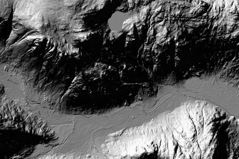
A hillshade rendered from the 1 m LiDAR terrain model covering almost all of England, served live.
How to add this service
- WMS address:
https://environment.data.gov.uk/spatialdata/lidar-composite-digital-terrain-model-dtm-1m/wms. The layer is Lidar_Composite_Hillshade_DTM_1m.
- The surface model with trees and buildings is the same address with
digital-surface-model-last-return-dsm-1m in place of digital-terrain-model-dtm-1m.
Report a problem with this entry
Northern Ireland
2 file sources, 1 paid
OSNI open data rasters
Ordnance Survey of Northern Ireland · GeoTIFF · Free · Open Government Licence, commercial use allowed
Northern Ireland's open base mapping as georeferenced rasters: the 1:10,000 Mid Scale Raster of the whole province and the StreetMaps of its towns, without contours.
How to download
- Open the Mid Scale Raster record and download the zip. The files are in Irish Grid.
Report a problem with this entry
OSNI 1:50,000 and 1:25,000 raster maps
Land & Property Services · GeoTIFF · Paid, £35.50 per 20 km 1:50,000 tile, £86.20 per 1:25,000 Activity Map, before VAT · Terms not stated on the product pages · OSNI Map Shop
The Discoverer-series 1:50,000 maps and the six 1:25,000 Activity Maps as TIFF files from the government map shop; priced for business use, but files you own.
How to buy
- Pick the tile or map in the shop, choose the TIF format, pay and download.
Report a problem with this entry
Scotland
2 services
NatureScot protected areas
NatureScot · WMS · Free · Open Government Licence · GetCapabilities
Overlay of Scotland's National Nature Reserves, Country and Regional Parks, Local Nature Reserves, SSSIs and other designations, as WMS with no background.
How to add this service
- WMS:
https://ogc.nature.scot/geoserver/protectedareas/ows
Layers include nnr, cpk, rp, lnr and sssi.
Report a problem with this entry
NatureScot landscape WMS and John Muir Way
NatureScot · WMS · Free · Open Government Licence · data.gov.uk record
WMS of NatureScot landscape datasets; the jmw layer draws the John Muir Way route, and lca the Landscape Character Assessment areas.
How to add this service
- WMS:
https://ogc.nature.scot/geoserver/landscape/ows
Overlay only, no background.
Report a problem with this entry
Wales
1 file source
Wales LiDAR hillshade
Welsh Government (DataMapWales) · GeoTIFF · Free · Open Government Licence · DataMapWales LiDAR viewer · Catalogue record
Hillshade of all of Wales from the 2020–23 LiDAR, as one large GeoTIFF.
How to download
- Open the DataMapWales LiDAR viewer page and scroll to the Cloud Optimized GeoTIFF links.
- Download the hillshade you want.
- DSM 1 m hillshade COG:
https://dmwproductionblob.blob.core.windows.net/cogs/wales_lidar_dsm_1m_hillshade_cog.tif
- DTM 1 m hillshade 2020-23 COG:
https://dmwproductionblob.blob.core.windows.net/cogs/dtm_1m_wales_hillshade_2020_23_cubic_cog.tif
- 2023 DSM pseudocolour hillshade COG:
https://dmwproductionblob.blob.core.windows.net/cogs/dsm_hillshade_pseudocolour_2023_cog.tif
The 1 m surface hillshade is in British National Grid; a bare-earth hillshade and a 2023 colour version are also offered. The files are large.
Report a problem with this entry
Ordnance Survey does not sell the Explorer or Landranger maps to walkers as files: it licenses the 1:25,000 and 1:50,000 rasters to businesses. The free OS files and the hillshade above are the options for TopoKit.
Ireland
Nationwide
Geological Survey Ireland bedrock geology
Geological Survey Ireland (Department of the Environment, Climate and Communications) · WMS · Free · CC BY 4.0 · Service page
Coloured 1:100,000 bedrock geology of Ireland with faults, folds and outcrops, as WMS.
How to add this service
- WMS:
https://gsi.geodata.gov.ie/server/services/Bedrock/IE_GSI_Bedrock_Geology_Datasets_100K_IE26_ITM/MapServer/WMSServer
Layer IE_GSI_Bedrock_Geology_100K_IE26_ITM. Attribution "Contains Irish Public Sector Data (Geological Survey Ireland)" is required. The ArcGIS tile cache is in Irish Transverse Mercator, so use the WMS.
Report a problem with this entry
Tailte Éireann (formerly Ordnance Survey Ireland) sells the Discovery 1:50,000 series on paper; its digital mapping is licensed to public bodies through MapGenie, and there is no open raster of it.
Spain
Nationwide
IGN topographic maps (MTN25 and MTN50)
Instituto Geográfico Nacional · WMS · Free · CC BY 4.0, credit ign.es · Capabilities
The national 1:25,000 and 1:50,000 topographic maps as one map service.
How to add this service
- WMS address:
https://www.ign.es/wms-inspire/mapa-raster. The layer is mtn_rasterizado.
Report a problem with this entry
PNOA orthophotos
Instituto Geográfico Nacional · WMS · Free · CC BY 4.0, credit scne.es · Capabilities
The most recent aerial photographs of Spain, with Sentinel-2 satellite imagery at small scales.
How to add this service
- WMS address:
https://www.ign.es/wms-inspire/pnoa-ma. The layer is OI.OrthoimageCoverage.
Report a problem with this entry
Camino de Santiago routes
Instituto Geográfico Nacional · WMS · Free · CC BY 4.0, credit ign.es · Capabilities
The Camino routes and their stages as a transparent overlay; the Camino Francés has a layer of its own, and the other routes are grouped by region.
How to add this service
- WMS address:
https://www.ign.es/wms-inspire/camino-santiago. Layers include camino_frances, caminos_norte, caminos_portugueses and caminos_francia.
Report a problem with this entry
The Camino de Santiago overlay above draws the routes and stages over any of these maps.
Portugal
Nationwide
OrtoSat 2023 imagery
Direção-Geral do Território · WMS · Free · No conditions stated, the service lists no fees and no access constraints · Capabilities
High-resolution satellite imagery of mainland Portugal from 2023, in true and false colour.
How to add this service
- WMS address:
https://ortos.dgterritorio.gov.pt/wms/ortosat2023. The true-colour layer is ortoSat2023-CorVerdadeira.
Report a problem with this entry
France
Nationwide
IGN Géoplateforme map services
IGN · WMS · Free · Licence Ouverte (Etalab), the default for Géoplateforme data unless a layer's metadata names another licence · Capabilities
The national map layers that need no key, among them Plan IGN, the 1:250,000 regional map, a hillshade and aerial photographs.
How to add this service
- WMS address:
https://data.geopf.fr/wms-r. Layers include GEOGRAPHICALGRIDSYSTEMS.PLANIGNV2 (Plan IGN), SCANREG_PYR-JPEG_WLD_WM (regional map), ELEVATION.ELEVATIONGRIDCOVERAGE.SHADOW (hillshade) and ORTHOIMAGERY.ORTHOPHOTOS (aerial photographs).
Report a problem with this entry
The IGN 1:25,000 map (SCAN 25) is not part of the free service.
Add or fix a map
Know of a map source I've missed? Looking for maps in an area that isn't listed, or found a broken link? Let me know so I can keep this list useful and up to date.
Or email me at support@topokit.ca.